Chatham Strait facts for kids
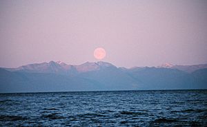
Chatham Strait is a long, narrow waterway in Southeast Alaska. It's also known as Shee ya xhaak in the Tlingit language. This strait is part of the Alexander Archipelago, a group of islands in the Pacific Ocean.
Chatham Strait acts like a natural divider. To its west, you'll find Chichagof Island and Baranof Island. On its east side are Admiralty Island and Kuiu Island. The strait stretches about 150 miles (241 km) from where Icy Strait and Lynn Canal meet, all the way south to the open sea. It's quite deep and measures between 3 to 10 miles (5–16 km) wide.
How Chatham Strait Got Its Name
The Tlingit name for Chatham Strait, Shee ya xhaak, has a special meaning. "Shee" refers to Baranof Island, "Ya" means face, and "Xhaak" means center. So, it describes the strait's location near Baranof Island.
Over time, many explorers and traders gave the strait different names. In 1775, a Spanish explorer named Juan Francisco de la Bodega y Quadra called the southern part "Ensenada del Principe." Later, in 1786, a French explorer named Jean-François de Galaup, comte de Lapérouse called it "Tschirikow Bay."
An early fur trader named James Colnett gave it the name "Christian Sound" in 1789. Other fur traders sometimes called it "Menzies Strait."
The name we use today, Chatham Strait, was given in 1794 by the British explorer George Vancouver. He named it to honor William Pitt, 1st Earl of Chatham. William Pitt was a very important politician in Great Britain. Vancouver also named Chatham Sound, which is further south in British Columbia, after William Pitt's son, John Pitt, 2nd Earl of Chatham. John's brother, William Pitt the Younger, also became a Prime Minister of Great Britain.
 | Janet Taylor Pickett |
 | Synthia Saint James |
 | Howardena Pindell |
 | Faith Ringgold |


