
Kuiu Island facts for kids

Kuiu
Location in Alaska
|
|
| Geography | |
|---|---|
| Location | Alaska Panhandle |
| Coordinates | 56°32′26″N 134°03′04″W / 56.54056°N 134.05111°W |
| Archipelago | Alexander Archipelago |
| Area | 747.556 sq mi (1,936.16 km2) |
| Length | 65 mi (105 km) |
| Width | 10–23 km (6.2–14.3 mi) |
| Administration | |
|
United States
|
|
| State | Alaska |
| Census Area | Prince of Wales–Hyder |
| Demographics | |
| Population | 10 (2000) |
| Pop. density | 0.005 /km2 (0.013 /sq mi) |
Kuiu Island is a large island located in southeastern Alaska. It is part of the Alexander Archipelago, a group of many islands. Kuiu Island sits between Kupreanof Island to its east and Baranof Island to its west.
This island is about 105 kilometers (65 miles) long. Its width changes, from about 10 kilometers (6 miles) to 23 kilometers (14 miles) wide. A narrow waterway called Affleck Canal almost cuts the island into two separate pieces. Kuiu Island has a land area of about 1,936 square kilometers (747 square miles). This makes it the 15th largest island in the United States.
The entire island is part of the Tongass National Forest. This is the largest national forest in the United States. In 2000, only 10 people lived on Kuiu Island, making it a very quiet place. Chatham Strait is a body of water that separates Kuiu Island from Baranof Island.
A lighthouse called the Cape Decision Light is found on the island. Kuiu Island is also home to two special wilderness areas: the Kuiu Wilderness and the Tebenkof Bay Wilderness. These areas are protected to keep their natural beauty and wildlife safe.
Island History
Kuiu Island was first mapped by European explorers in the late 1700s. Joseph Whidbey and James Johnstone were two men who worked with George Vancouver. They explored the area between 1793 and 1794. Johnstone was the one who proved that Kuiu was truly an island, not connected to the mainland.
Images for kids
-
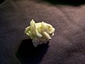
Barrerite from Rocky Pass, Kuiu Island.

See also
 In Spanish: Isla Kuiu para niños
