Chilpancingo National Airport facts for kids
Quick facts for kids
Chilpancingo National Airport
Aeropuerto Nacional de Chilpancingo
|
|||||||||||
|---|---|---|---|---|---|---|---|---|---|---|---|
| Summary | |||||||||||
| Airport type | Public | ||||||||||
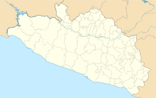
| Serves | Chilpancingo | ||||||||||
| Elevation AMSL | 4,199 ft / 1,279 m | ||||||||||
| Coordinates | 17°34′26″N 99°30′52″W / 17.57389°N 99.51444°W | ||||||||||
| Map | |||||||||||
| Runway | |||||||||||
|
|||||||||||
| Statistics (2019) | |||||||||||
|
|||||||||||
|
Source: Agencia Federal de Aviación Civil
|
|||||||||||
The Chilpancingo National Airport is an airport found in the city of Chilpancingo, which is in Guerrero, México. It's a public airport, meaning anyone can use it, though it mainly serves a special type of flying.
This airport is mostly for General Aviation. This means it's used by smaller planes, like private jets, air taxis, or planes for training. It's not used by big passenger planes or cargo planes that carry lots of goods. So, you won't find major airlines flying in and out of here.
Airport Codes
Every airport has special codes to identify it. The Chilpancingo National Airport has an ICAO code, which is MMCH. ICAO stands for the International Civil Aviation Organization. This code helps air traffic controllers around the world know exactly which airport a plane is going to or coming from.
However, this airport does not have an IATA code yet. IATA stands for the International Air Transport Association. These codes are usually given to airports that have regular commercial flights, like those carrying passengers on big airlines. Since Chilpancingo National Airport doesn't have those, it doesn't need an IATA code.
Runway Details
The airport has only one runway. A runway is the long, flat strip of land where planes take off and land. This runway is located on the northern side of the city of Chilpancingo.
The runway is quite long, measuring about 1,406 meters (or 4,615 feet). That's more than a kilometer long! It is made of asphalt, which is a common material for airport runways. The runway is marked as 33/15, which tells pilots its direction.
See also
 In Spanish: Aeropuerto Nacional de Chilpancingo para niños


