Chincoteague Inlet facts for kids
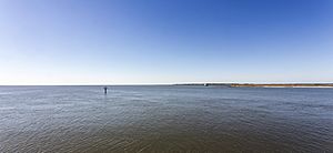
Chincoteague Inlet is a waterway located on the Eastern Shore of Virginia. It lies between two islands, Assateague Island and Wallops Island. This inlet is about 30 miles south of Ocean City, Maryland. It's an important passage for boats in the area.
Exploring Chincoteague Inlet
Chincoteague Inlet is a natural opening that connects the ocean to the calmer waters behind the islands. It's a busy spot for boats and a key part of the local environment.
Finding Your Way
When boats approach Chincoteague Inlet from the ocean, there isn't a main sea buoy right at the entrance. However, there is a special lighted buoy called "R 2" that helps guide them. This buoy marks the Chincoteague Shoals and is located southeast of the inlet's entrance at 37°47’25" N and 075°22’21" W. It acts like a helpful sign for sailors.
You can also easily spot two important landmarks from far away. One is the Assateague Light, a tall lighthouse that is 142 feet high. It has red and white stripes. The other is a lookout tower on the southern tip of Assateague Island. Both of these are very visible and help boaters find their way.
Changing Channels
The path for boats through Chincoteague Inlet can change often. This is because sand and water currents are always moving. The buoys, which are floating markers, are moved regularly to show the safest way for boats to pass. Sometimes, you might see waves breaking on either side of the main channel. This shows where the water is shallower.
Important Safety Note
Boaters need to be careful when navigating the inlet. There is a sunken boat wreck about 0.4 miles southwest of Fishing Point. Its exact location is 37°51’54" N and 75°24’04" W. Knowing about this wreck helps ensure safe passage for all vessels.
 | Precious Adams |
 | Lauren Anderson |
 | Janet Collins |


