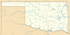
Clarita, Oklahoma facts for kids
Quick facts for kids
Clarita, Oklahoma
|
|
|---|---|
| Country | United States |
| State | Oklahoma |
| County | Coal |
| Area | |
| • Total | 7.91 sq mi (20.48 km2) |
| • Land | 7.90 sq mi (20.47 km2) |
| • Water | 0.00 sq mi (0.01 km2) |
| Elevation | 692 ft (211 m) |
| Population
(2020)
|
|
| • Total | 135 |
| • Density | 17.08/sq mi (6.60/km2) |
| Time zone | UTC-6 (Central (CST)) |
| • Summer (DST) | UTC-5 (CDT) |
| FIPS code | 40-14750 |
| GNIS feature ID | 2629912 |
Clarita is a small community in Coal County, Oklahoma, in the United States. It is an unincorporated community. This means it does not have its own local government. The post office in Clarita first opened on January 19, 1910.
About Clarita
Clarita was once part of the Olney Public School District. This school district was known for being very small. For example, it had only 58 students from kindergarten to 12th grade. The Olney School is now closed. However, people who used to go there still hold reunions in the old lunch room.
In 2015, the U.S. Census Bureau created a special area for Clarita. This area is called a "census-designated place" (CDP). It helps the government collect information about the population. In 2010, this specific area had 171 people living in it. There were also 70 housing units within its boundaries.
Population Facts
The number of people living in Clarita has changed over time. The U.S. Census Bureau counts the population every ten years.
| Historical population | |||
|---|---|---|---|
| Census | Pop. | %± | |
| 2020 | 135 | — | |
| U.S. Decennial Census | |||
In 2020, the population of Clarita was 135 people. This shows how many people lived in the area at that time.
 | James Van Der Zee |
 | Alma Thomas |
 | Ellis Wilson |
 | Margaret Taylor-Burroughs |


