Coal County, Oklahoma facts for kids
Quick facts for kids
Coal County
|
|
|---|---|

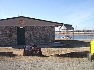
Park in Coalgate
|
|

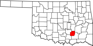
Location within the U.S. state of Oklahoma
|
|
 Oklahoma's location within the U.S. |
|
| Country | |
| State | |
| Founded | 1907 |
| Seat | Coalgate |
| Largest city | Coalgate |
| Area | |
| • Total | 521 sq mi (1,350 km2) |
| • Land | 517 sq mi (1,340 km2) |
| • Water | 4.7 sq mi (12 km2) 0.9%% |
| Population
(2020)
|
|
| • Total | 5,266 |
| • Density | 10.107/sq mi (3.903/km2) |
| Time zone | UTC−6 (Central) |
| • Summer (DST) | UTC−5 (CDT) |
| Congressional district | 2nd |
Coal County is a county in the state of Oklahoma. It is located in the southeastern part of the state. In 2020, about 5,266 people lived there. The main town and county seat (where the county government is) is Coalgate.
Contents
History of Coal County
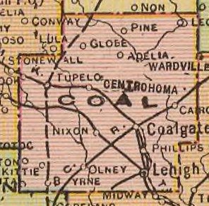
Coal County was created in 1907 when Oklahoma became a state. Before that, this area was part of the Indian Territory. It was specifically part of the Choctaw Nation and a small piece of the Chickasaw Nation.
At first, the state government chose Lehigh as the county seat. But in 1908, the people of the county voted. They chose Coalgate to be the new county seat instead.
Mining and Farming
Mining for coal was very important to Coal County's economy starting in the 1870s. The first coal mine opened on land owned by Chief Allen Wright. The busiest time for mining was between 1910 and 1916.
However, after World War I, many mines closed. This was partly because mining companies did not want to allow workers to form unions. Some mines opened again during World War II, but they closed for good by 1958. It became too expensive to remove sulfur from the coal.
After mining declined, farming became the main way people made a living. But even farming faced big problems. From 1921 to 1923, tiny bugs called boll weevils destroyed the cotton crops. Because of this, all five banks in the county failed.
Geography of Coal County
Coal County is in southeastern Oklahoma. It is part of a special area called Choctaw Country, which is known for tourism. The county covers about 521 square miles. Most of this is land, with a small amount of water. It is the fifth smallest county in Oklahoma by land area.
The eastern part of the county has hills and is part of the Ouachita Mountains. The western part has flat, open grasslands. Two creeks, the Clear Boggy and Muddy Boggy, flow through the county.
Major Roads
Neighboring Counties
Coal County shares borders with these counties:
- Hughes County (north)
- Pittsburg County (northeast)
- Atoka County (southeast)
- Johnston County (southwest)
- Pontotoc County (west)
People of Coal County (Demographics)
| Historical population | |||
|---|---|---|---|
| Census | Pop. | %± | |
| 1910 | 15,817 | — | |
| 1920 | 18,406 | 16.4% | |
| 1930 | 11,521 | −37.4% | |
| 1940 | 12,811 | 11.2% | |
| 1950 | 8,056 | −37.1% | |
| 1960 | 5,546 | −31.2% | |
| 1970 | 5,525 | −0.4% | |
| 1980 | 6,041 | 9.3% | |
| 1990 | 5,780 | −4.3% | |
| 2000 | 6,031 | 4.3% | |
| 2010 | 5,925 | −1.8% | |
| 2020 | 5,266 | −11.1% | |
| U.S. Decennial Census 1790-1960 1900-1990 1990-2000 2010 |
|||
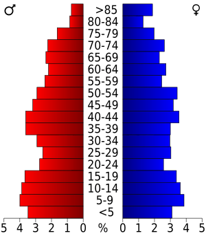
In 2010, there were about 5,295 people living in Coal County. Most people (74.3%) were White. A good number of people (16.7%) were Native American. About 7.8% of people were from two or more races. A small number (2.6%) were Hispanic or Latino.
The average age in the county was 41 years old. About 25.5% of the population was under 18 years old.
Most people in Coal County speak English. Some also speak Spanish or Choctaw.
Towns and Communities
Cities
- Coalgate (the county seat)
- Centrahoma
- Lehigh
- Tupelo
Towns
Other Communities
- Clarita (a census-designated place)
- Cairo
- Cottonwood
- Olney
Historical Places (NRHP sites)
Several places in Coal County are listed on the National Register of Historic Places. These are important historical sites:
- Benjamin Franklin Smallwood House, Lehigh
- Coalgate School Gymnasium-Auditorium, Coalgate
- Keel Creek Bridge, Coalgate
- Merchants National Bank Building, Lehigh
- United States Post Office Coalgate, Coalgate
See also
 In Spanish: Condado de Coal para niños
 | Audre Lorde |
 | John Berry Meachum |
 | Ferdinand Lee Barnett |


