Centrahoma, Oklahoma facts for kids
Quick facts for kids
Centrahoma, Oklahoma
|
|
|---|---|

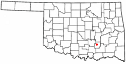
Location of Centrahoma, Oklahoma
|
|
| Country | United States |
| State | Oklahoma |
| County | Coal |
| Area | |
| • Total | 0.25 sq mi (0.65 km2) |
| • Land | 0.25 sq mi (0.65 km2) |
| • Water | 0.00 sq mi (0.00 km2) |
| Elevation | 705 ft (215 m) |
| Population
(2020)
|
|
| • Total | 81 |
| • Density | 322.71/sq mi (124.40/km2) |
| Time zone | UTC-6 (Central (CST)) |
| • Summer (DST) | UTC-5 (CDT) |
| ZIP code |
74534
|
| Area code(s) | 580 |
| FIPS code | 40-13100 |
| GNIS feature ID | 2409426 |
Centrahoma is a small, rural town located in Coal County, Oklahoma, United States. It is a peaceful place to live. In 2020, the town had a population of 81 people, according to the 2020 census.
Contents
History of Centrahoma
The area where Centrahoma is now was first known as Byrd, Indian Territory. A post office opened there on March 3, 1892. It was named after William L. Byrd, who was the Governor of the Chickasaw Nation.
Name Changes Over Time
The name of the post office changed to Owl, Indian Territory, on July 10, 1894. This new name came from a nearby stream called Owl Creek. Owl Creek is a branch of Leader Creek, which flows into Clear Boggy Creek.
Later, on June 11, 1907, the post office moved a few miles northeast. At that time, its name was changed again to Centrahoma, Indian Territory. The name "Centrahoma" was created by combining "central" and "Oklahoma."
Geography of Centrahoma
Centrahoma is located in the northwest part of Coal County. Oklahoma State Highway 3 runs just south of the town. This highway connects Centrahoma to other cities.
Nearby Cities and Area
If you travel northwest on Highway 3, you will reach Ada, which is about 24 miles away. If you go southeast, you will arrive at Atoka, about 22 miles away.
According to the United States Census Bureau, the town covers a total area of about 0.6 square kilometers (0.25 square miles). All of this area is land, with no water.
Population and People
Centrahoma is a very small town. Its population has changed over the years.
| Historical population | |||
|---|---|---|---|
| Census | Pop. | %± | |
| 1960 | 148 | — | |
| 1970 | 155 | 4.7% | |
| 1980 | 166 | 7.1% | |
| 1990 | 106 | −36.1% | |
| 2000 | 110 | 3.8% | |
| 2010 | 97 | −11.8% | |
| 2020 | 81 | −16.5% | |
| U.S. Decennial Census | |||
In 2000, there were 110 people living in Centrahoma. These people lived in 36 different households. Most of these households were families.
Population Details
The average household in Centrahoma had about three people living in it. The average family had slightly more than three people.
The population included people of different ages. About 39% of the people were under 18 years old. About 12% were 65 years old or older. The average age of people in the town was 29 years.
See also

- In Spanish: Centrahoma (Oklahoma) para niños

