Clayton Center, Iowa facts for kids
Quick facts for kids
Clayton Center, Iowa
|
|
|---|---|

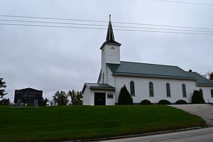
Zion Lutheran Church in Clayton Center
|
|
| Country | United States |
| State | Iowa |
| County | Clayton |
| Elevation | 988 ft (301 m) |
| Time zone | UTC-6 (Central (CST)) |
| • Summer (DST) | UTC-5 (CDT) |
| Area code(s) | 563 |
| GNIS feature ID | 455451 |
Clayton Center is a small place in Clayton County, Iowa, United States. It's called an unincorporated community, which means it's not an official town or city with its own local government. Instead, it's part of the larger county.
Contents
History of Clayton Center
How Clayton Center Started
Clayton Center began as a place where German families settled. It's about five miles east of a town called Elkader.
In April 1856, a person named Lewis Brockman looked at the land. He marked out where the community would be. Then, on June 27, 1857, Fred Hartmann officially planned the layout of Clayton Center. This process is called platting, which means drawing a map to divide land into lots for buildings and streets.
Population Over Time
Clayton Center has always been a small community. In 1902, about 94 people lived there. By 1940, the population had grown a bit to 162 people.
Education in Clayton Center
Local Schools
Students in Clayton Center go to public schools managed by the Clayton Ridge Community School District. This school district was created in 2005. It was formed when two other school districts, Guttenberg and Garnavillo Community School District, joined together. Before this merger, students from Clayton Center attended schools in Garnavillo.
 | Janet Taylor Pickett |
 | Synthia Saint James |
 | Howardena Pindell |
 | Faith Ringgold |

