
Clifton, Louisville facts for kids
Quick facts for kids |
|
|
Clifton Historic District
|
|

Frankfort Ave in Clifton
|
|
| Lua error in Module:Location_map at line 420: attempt to index field 'wikibase' (a nil value). | |
| Location | Roughly bounded by Brownsboro Rd., William and E. Main Sts., Frankfort and N. Ewing Aves., Louisville, Kentucky |
|---|---|
| Area | 169 acres (68 ha) |
| Built | 1870 |
| Architectural style | Italianate, Queen Anne, Classical Revival |
| NRHP reference No. | 83002649 |
| Added to NRHP | August 29, 1983 |
Clifton is a cool neighborhood located just east of downtown Louisville, Kentucky. It got its name because it's built on hills overlooking the Ohio River valley. You can find Clifton bordered by I-64, N Ewing Avenue, Brownsboro Road, and Mellwood Avenue.
Exploring Clifton's Past
Clifton is special because it grew slowly over 60 years, starting in the 1860s. This means you can see homes built at different times, right next to each other! Most of these homes were built in the beautiful Victorian style.
Unlike some other parts of Louisville, Clifton's neighborhoods aren't as crowded. The main road, Frankfort Avenue, used to be a toll road connecting Louisville and Lexington, Kentucky. Today, it's a lively street filled with small shops.
Clifton's Comeback Story
In the 1990s, Clifton started to become a popular spot again. Many new restaurants, unique boutiques, and antique shops opened along Frankfort Avenue. It's a great place to explore!
You can also find some important places here, like the Kentucky School for the Blind. This school helps students who are blind or visually impaired. Another cool place is the American Printing House for the Blind, which creates books and materials for people with vision loss.
Clifton's Community
In 2000, about 2,469 people lived in Clifton. Most residents were white (87.2%), and about 8.1% were black. Many people in Clifton have gone to college, with 32.1% having a college degree.
Images for kids
-
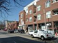
New Condos in Clifton
-
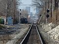
View of Downtown Louisville from railroad tracks in Clifton


