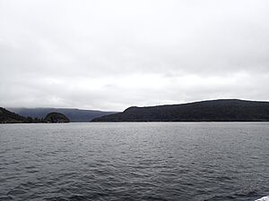
Coal Island, New Zealand facts for kids
|
Native name:
Te Puka Hereka
|
|
|---|---|
|
Location in New Zealand
|
|
| Geography | |
| Location | Fiordland |
| Coordinates | 46°7′S 166°38′E / 46.117°S 166.633°E |
| Area | 11.63 km2 (4.49 sq mi) |
| Highest elevation | 251 m (823 ft) |
| Administration | |
| Demographics | |
| Population | 0 |
Coal Island is a special island located in Fiordland, in the southwest of New Zealand's South Island. Its Māori name is Te Puka-Hereka, which means "The Tied Anchor." Even though it has a Māori name, most people know it as Coal Island.
This island is found at the southern end of Fiordland's west coast. It sits right at the entrance to Preservation Inlet. This area has the southernmost fiords of Fiordland. It is about 200 kilometers (124 miles) south of Milford Sound.
Discovering Coal Island
Coal Island is a beautiful and important island in the southwest of New Zealand's South Island. It is part of the stunning Fiordland National Park. The island's highest point reaches 251 meters (about 823 feet) above sea level. No people live on Coal Island, making it a true wilderness area.
A Safe Home for Wildlife
Coal Island is very important for protecting New Zealand's unique animals. It was declared "pest-free" in 2005. This means that harmful animals like rats, stoats, and possums have been removed from the island. These animals are called "introduced mammalian pests" because they were brought to New Zealand by people and harm native wildlife.
Being pest-free makes Coal Island a safe place for rare birds. It is one of only nine islands in the area that has no introduced pests. Since 2005, endangered native birds have been released there. These include the tokoeka (a type of kiwi) and the mohua (also known as the yellowhead). These birds can now live and breed safely on Coal Island.
 | William L. Dawson |
 | W. E. B. Du Bois |
 | Harry Belafonte |


