Fiordland facts for kids
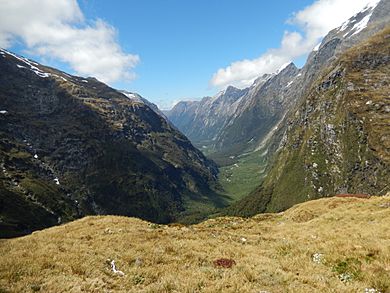
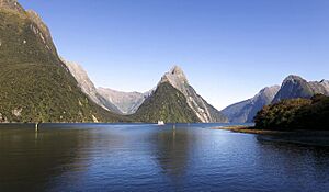
Fiordland (which Māori call Māori: Te Rua-o-te-Moko, meaning "The Pit of Tattooing") is a special part of New Zealand. It's located in the southwest corner of the South Island, making up the western side of the Southland area. Most of Fiordland is covered by the tall, snow-capped Southern Alps, deep lakes, and steep valleys that were carved by glaciers and are now filled with ocean water.
The name "Fiordland" comes from the word "fjord", which is a Scandinavian word for these deep, narrow valleys with steep sides. This whole area is mostly covered by Fiordland National Park, which is New Zealand's biggest national park.
Because the land is so steep and gets a lot of rain, which helps plants grow thickly, it's very hard to get into the middle of Fiordland. This means that people never really cut down many trees here. Even attempts to hunt whales, seals, or mine for minerals were small and didn't last long, partly because of the tough weather. Today, Fiordland has the largest amount of untouched nature in New Zealand. It's home to many unique plants and animals that are found nowhere else, and some of them are endangered.
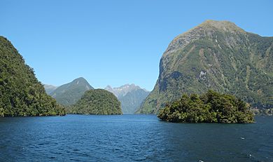
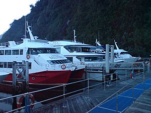
Fiordland has many fiords, which are often called "sounds" here. Of the twelve main fiords on Fiordland's west coast, Milford Sound / Piopiotahi is the most famous. It's also the only one you can reach by road. Doubtful Sound / Patea is much bigger and is also a popular place for tourists, but it's harder to get to. You need to take a boat across Lake Manapouri and then a bus over Wilmot Pass.
Fiordland also has some of the world's tallest waterfalls, like Browne Falls and Sutherland Falls. New Zealand's three deepest lakes—Lake Hauroko, Lake Manapouri, and Lake Te Anau—are also found here. This area, along with nearby parts of Southland and Otago, is often called the Southern Lakes. Only a few of Fiordland's lakes can be reached by road. Lake Poteriteri is the largest lake in New Zealand that has no road access at all. Many lakes in the region can't even be reached by walking tracks.
This part of New Zealand, especially west of the Southern Alps mountains, has a very wet climate. It rains about 200 days a year! The amount of rain changes from about 1,200 mm in Te Anau to a huge 8,000 mm in Milford Sound. Strong westerly winds blow moist air from the Tasman Sea onto the mountains. As the air rises and cools, it drops a lot of rain.
Contents
History of Fiordland
Fiordland has never had many people living there all the time. The Māori knew the area well and visited it during certain seasons. They came to hunt, fish, and collect a special green stone called pounamu (New Zealand jade) from Anita Bay, near the mouth of Milford Sound / Piopiotahi.
In Māori mythology, it's believed that the demigod Tū-te-raki-whānoa created Fiordland. He carved the fiords out of rock using his adze. As he moved north, he got better at his carving. He thought Milford Sound / Piopiotahi was his best work.
The Māori name Te Rua-o-te-Moko ("The Pit of Tattooing") comes from a story about the Tākitimu migratory waka (canoe) visiting the area. Old stories say that the captain of the waka, Tamatea, lost his tattooing ink in Taiari / Chalky Inlet. After the Tākitimu was damaged at Te Waewae Bay, the crew decided to walk north. When they stopped at Te Anau, Tamatea decided to dig a pit to burn wood and make soot for tattoo ink. Over time, this name came to describe the whole Fiordland area.
In 1770, Captain James Cook and his crew were the first Europeans to see Fiordland. Cook came back in 1773 and stayed in Tamatea / Dusky Sound for five weeks. His maps and descriptions of the area attracted whalers and seal hunters. However, it wasn't until the mid-1800s that explorers and people looking for minerals started to explore the inside of Fiordland.
Between 1897 and 1908, two attempts to start mining in the faraway area of Rakituma / Preservation Inlet failed. By 1914, the small, isolated settlement of Cromartie (or Cromarty) there was empty.
The area was managed as Fiord County from 1876 until it joined Wallace County in 1981. Since 1989, it has been part of Southland District and the larger Southland Region.
Geography of Fiordland
Fiordland is a huge mountainous region west of the line from Te Waewae Bay to Monowai to Te Anau. It includes the valleys of the Eglinton River and Hollyford River / Whakatipu Kā Tuka. This area is almost the same as the Fiordland National Park. It has U-shaped valleys and fiords along the coast. The mountains are made of very hard rocks like gneiss, schist, granite, and diorite. Softer rocks were carved out by many ice ages. Fiordland has New Zealand's oldest known igneous rocks (formed from cooled magma). The mountains here are the southernmost part of the Southern Alps, and they get shorter as you go from north to south.
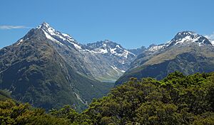
The tallest mountain in Fiordland is Mount Tūtoko, which is 2,723 meters high. It's one of several peaks over 2,000 meters in the Darran Mountains. Southeast of this area, there are only a few peaks that reach 2,000 meters. However, because of the rainy weather, cold winters, and cool summers, even these mountains have glaciers and peaks with snow all year round. The southernmost glacier is on Caroline Peak, which is only 1,704 meters high. In the southwest of Fiordland, the height for permanent snowfields drops to under 1,500 meters.
The deep carving by glaciers in the past also created fiord-like arms in Lake Manapouri and Lake Te Anau. Along the coast, several large pieces of the mainland were cut off, forming islands. The largest of these uninhabited islands are Resolution Island and Secretary Island. These islands are important places for conservation, especially as safe homes for endangered native birds.
Fiords of Fiordland
There are twelve fiords, some stretching up to 40 km inland, and two inlets that lead to three more fiords. They run along the coast from Piopiotahi in the north to Rakituma / Preservation Inlet in the south. Generally, the fiords get wider from north to south as the mountains get shorter. The southernmost fiords look more like inlets, with only their inner arms, like Long Sound, truly resembling fiords.
Here are some of the main fiords:
- Milford Sound / Piopiotahi - the only fiord you can drive to.
- Te Hāpua / Sutherland Sound
- Hāwea / Bligh Sound
- Te Houhou / George Sound - you can reach it by a walking track.
- Taitetimu / Caswell Sound
- Taiporoporo / Charles Sound
- Hinenui / Nancy Sound
- Te Awa-o-Tū / Thompson Sound
- Doubtful Sound / Patea - you can visit it with tours or by a walking track.
- Te Rā / Dagg Sound
- Te Puaitaha / Breaksea Sound
- Tamatea / Dusky Sound - you can reach it by a walking track.
- Taiari / Chalky Inlet - this leads into Edwardson Sound and Kanáris Sound.
- Rakituma / Preservation Inlet - this leads into Long Sound.
There's also Kaikiekie / Bradshaw Sound, which is like an extension of Thompson and Doubtful Sounds after they meet at the eastern end of Secretary Island.
Ecology and Wildlife
Fiordland is known as the Fiordland temperate forests ecoregion. It has many different types of natural homes for plants and animals. Because it's so isolated, it has a high number of unique plants found nowhere else. Most of Fiordland is covered in thick forests, except where there are large areas of bare rock. The natural habitats are almost completely untouched.
Nothofagus beech trees are common in many places. Silver beech (Nothofagus menziesii) grows in the fiords, and red beech (Nothofagus fusca) grows in the inland valleys. Below these trees, you'll find many different shrubs and ferns, like the crown fern (Blechnum discolor). Above the treeline, there are areas of small, scrubby plants. You can also find patches of bog next to mountain streams and an area of rimu (Dacrydium cupressinum) trees on the south coast. Even though Fiordland is not very far south, the treeline is usually below 1,000 meters. This is because of the cool summers and the influence of the Southern Ocean on the weather.
The area is home to endangered native bird species that can't fly, like the takahē and kiwi. Other special birds include the blue duck (whio) and the yellowhead (mōhua). The takahē was thought to be extinct for 50 years until a small group was found in Fiordland's Murchison Mountains in 1948. Since then, the Department of Conservation has worked to protect them by trapping stoats and controlling deer. These efforts have helped the takahē population in the area grow to over 200 birds.
Fiordland also has many insects and one native reptile, the Fiordland skink (Oligosoma acrinasum). There are about 300 insect species that are only found in Fiordland. Many of them are quite large, like weta, big caddisflies, and giant weevils. Some are unusual, like egg-laying worms, alpine cicadas, and brightly colored alpine moths. There are also six types of native sandflies, with one type found only in Fiordland.
Most of Fiordland is protected as part of the Fiordland National Park. This park is part of the Te Wahipounamu World Heritage Site. Fiordland National Park covers 12,600 square kilometers, making it the largest national park in New Zealand and one of the biggest parks in the world. It includes many popular tourist spots like Milford Sound, Doubtful Sound, and the Milford Track. The main danger to the natural habitats comes from introduced species, especially red deer. However, these deer are now being hunted to control their numbers. The park also includes several small islands offshore that are free from introduced species and are special protected areas.
Marine Reserves
Ten marine reserves have been created in Fiordland to protect many different kinds of sea creatures and their homes.
The first two reserves were set up in 1993:
- Piopiotahi (Milford Sound) Marine Reserve
- Te Awaatu Channel (The Gut) Marine Reserve
Eight more reserves were added in 2005:
- Hawea (Clio Rocks) Marine Reserve
- Kahukura (Gold Arm) Marine Reserve
- Kutu Parera (Gaer Arm) Marine Reserve
- Moana Uta (Wet Jacket Arm) Marine Reserve
- Taipari Roa (Elizabeth Island) Marine Reserve
- Taumoana (Five Fingers Peninsula) Marine Reserve
- Te Hapua (Sutherland Sound) Marine Reserve
- Te Tapuwae o Hua (Long Sound) Marine Reserve
People and Economy
Fiordland is a very large area, but very few people live there. Almost everyone lives in the small village at Milford Sound (village). In 2018, only 111 people lived in the whole Fiordland statistical area.
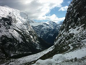
Apart from the areas around the towns of Te Anau and Manapouri (which are not part of the Fiordland statistical area), Fiordland has always had very few people. It's the least populated part of the South Island, with no villages or towns. Many areas are almost impossible to reach except by boat or plane. The closest city is Invercargill, about 80 km east of the southern end of Fiordland. The only main road in Fiordland is State Highway 94, also called Milford Road, which connects Te Anau with Milford Sound.
Blanket Bay Hotel is not a real hotel, but a small place where fishermen can refuel and get supplies. It has a small jetty and a helipad and is located on a small island at the head of Doubtful Sound / Patea. It might be the westernmost place where people live in New Zealand.
The main economic activities in Fiordland are making electricity (at the Manapouri Power Station and a smaller power station at Lake Monowai) and some farming. However, tourism is the biggest part of the economy. In 2003, visitors spent NZ$92 million, and over 1,000 people worked full-time in tourism. Most tourists visit Milford Sound / Piopiotahi, and walking in the easier-to-reach eastern parts of the mountains is also popular. Still, because the region is so remote, even tourism is limited. After short visits to the main sites, most tourists return to other areas like Queenstown or Invercargill.
See also
 In Spanish: Fiordland para niños
 | May Edward Chinn |
 | Rebecca Cole |
 | Alexa Canady |
 | Dorothy Lavinia Brown |


