Southland District facts for kids
Quick facts for kids
Southland District
|
|
|---|---|
|
Territorial authority district
|
|

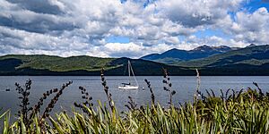
Lake Te Anau
|
|

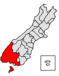
Location of the Southland District within the South Island
|
|
| Country | New Zealand |
| Region | Southland Region |
| Communities |
|
| Wards |
|
| Formed | 1989 |
| Seat | Invercargill |
| Area | |
| • Land | 29,575.19 km2 (11,419.04 sq mi) |
| Population
(June 2023)
|
|
| • Total | 33,000 |
| Time zone | UTC+12 (NZST) |
| • Summer (DST) | UTC+13 (NZDT) |
| Postcode(s) |
Map of postcodes
|
The Southland District is a special area in New Zealand. It's a type of local government area called a territorial authority district. This district covers most of the southern part of the South Island. It also includes Stewart Island, which is a large island south of the South Island.
Contents
History of Southland District
The Southland District was created in 1989. This happened during a big change to local governments in New Zealand. Four smaller local areas joined together to form the new district. These were Wallace County, Winton Borough, Stewart Island County, and most of Southland County.
John Casey was the first mayor of the Southland District. He had been involved in local government since 1977. He helped bring the different areas together.
Later, in 2019, the Winton Wallacetown Ward changed its name. It became the Oreti Ward. The Oreti River flows through this area.
Geography of Southland District
The Southland District covers most of the land in the Southland Region. However, the region also includes Gore District and Invercargill City. The district's land area is about 29,574.53 square kilometers. This measurement does not include large inland lakes. Some of these lakes are Lake Te Anau, Lake Manapouri, and Lake Hauroko.
The Southland District also includes several islands south of Foveaux Strait. These islands are:
The main office for the district council is in Invercargill. But Invercargill City is actually its own separate local government area. It is not part of the Southland District itself.
Two of New Zealand's biggest national parks are found within the Southland District. These are Fiordland National Park and Rakiura National Park. Rakiura National Park covers most of Stewart Island/Rakiura.
Towns and Settlements
The Southland District has three towns with more than 1,000 people. These towns are home to about 21.7% of all the people living in the district.
| Urban area | Population
(June 2023) |
% of district |
|---|---|---|
| Te Anau | 3,060 | 9.3% |
| Winton | 2,460 | 7.5% |
| Riverton | 1,640 | 5.0% |
Many other smaller towns and communities are located throughout the district. These are grouped into different wards.
Mararoa Waimea Ward
|
|
|
Waiau Aparima Ward
Waihopai Toetoe Ward
|
Oreti Ward
|
Stewart Island-Rakiura Ward
- Oban
- Port Pegasus (uninhabited)
- Port William (uninhabited)
Population and People
The Southland District covers about 29,575 square kilometers. In 2023, about 31,833 people lived there. This means there are about 1.1 people for every square kilometer.
| Ethnicity | Population |
|---|---|
| New Zealand European |
27,465
|
| Māori |
4,137
|
| Pasifika |
453
|
| Asian |
2,409
|
| MELAA |
252
|
| Other |
591
|
| Historical population | ||
|---|---|---|
| Year | Pop. | ±% p.a. |
| 2006 | 28,437 | — |
| 2013 | 29,613 | +0.58% |
| 2018 | 30,864 | +0.83% |
| 2023 | 31,833 | +0.62% |
The population of the Southland District has grown over time. In 2023, there were 969 more people than in 2018. The number of homes was 16,887. The average age of people living here was 40.3 years old. This is a bit older than the national average of 38.1 years.
About 20.1% of the people were under 15 years old. About 15.8% were between 15 and 29 years old. Most people, 46.7%, were between 30 and 64 years old. About 17.4% were 65 years or older.
People in the Southland District come from many different backgrounds. In 2023, about 86.3% were European/Pākehā. About 13.0% were Māori. Smaller groups included Pasifika (1.4%) and Asian (7.6%). Some people identify with more than one ethnic group.
About 13.6% of the people in Southland District were born outside New Zealand. This is lower than the national average of 27.1%.
When asked about their religious beliefs, many people (51.7%) said they had no religion. About 38.4% were Christian. Smaller numbers followed Māori religious beliefs, Hinduism, Islam, or Buddhism.
For those aged 15 and older, about 13.8% had a university degree or higher. About 23.6% did not have formal qualifications. The average income was $36,300. This was higher than the national average of $31,800. Many people (57.4%) worked full-time. About 16.7% worked part-time, and 2.1% were looking for work.
| Name | Area (km2) | Population | Density (per km2) | Homes | Average age | Average income |
|---|---|---|---|---|---|---|
| Mararoa-Waimea Ward | 17,420.86 | 7,953 | 0.46 | 3,081 | 38.8 years | $36,800 |
| Waiau-Aparima Ward | 6,381.17 | 7,908 | 1.24 | 3,153 | 40.6 years | $31,900 |
| Oreti Ward | 1,826.23 | 9,117 | 4.99 | 3,468 | 39.1 years | $38,600 |
| Waihopai-Toetoe Ward | 2,176.35 | 5,481 | 2.52 | 2,055 | 37.2 years | $37,900 |
| Stewart Island/Rakiura Ward | 1,747.74 | 408 | 0.22 | 222 | 49.3 years | $33,500 |
| New Zealand | 37.4 years | $31,800 |
Sister Cities
A sister city is a partnership between two cities or regions in different countries. They agree to promote cultural and commercial ties.
Current Sister City
Former Sister City
 Wyong Shire, New South Wales, Australia
The Southland District used to be a sister city with Wyong Shire in New South Wales, Australia. This partnership ended in 2010.
See also
 In Spanish: Distrito Southland para niños
 | Audre Lorde |
 | John Berry Meachum |
 | Ferdinand Lee Barnett |


