Te Anau facts for kids
Quick facts for kids
Te Anau
|
|
|---|---|
 |
|
| Country | New Zealand |
| Island | South Island |
| Region | Southland region |
| Territorial authorities of New Zealand | Southland District |
| Ward | Mararoa Waimea Ward |
| Community | Fiordland Community |
| Electorates |
|
| Area | |
| • Total | 6.64 km2 (2.56 sq mi) |
| Population
(June 2023)
|
|
| • Total | 3,060 |
| • Density | 460.8/km2 (1,193.6/sq mi) |
| Postcode(s) |
9600
|
| Area code(s) | 03 |
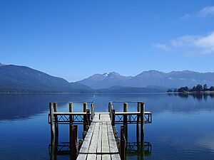
Te Anau is a town in the Southland region of the South Island of New Zealand. In the Māori language, Te-Anau means "the Place of the Swirling Waters." It is located on the eastern shore of Lake Te Anau in Fiordland.
Te Anau is about 155 kilometres north of Invercargill. It is also 171 kilometres southwest of Queenstown. The town of Manapouri is 21 kilometres to the south. Te Anau is at the southern end of the Milford Road (State Highway 94), which leads to Milford Sound.
Contents
History of Te Anau
The first Europeans to visit Lake Te Anau were C.J. Nairn and W.J. Stephen in 1852. They were guided by Māori people. The lake was officially mapped in 1863. The town itself was mapped out in 1893. This happened soon after the famous Milford Track opened.
Te Anau really started to grow after the Homer Tunnel and the road to Milford opened in 1953. This made it much easier for people to visit the area.
People of Te Anau
Te Anau covers about 6.64 square kilometres. As of 2023, it had an estimated population of about 3,300 people. This means there are about 500 people living in each square kilometre.
In 2018, the town had 2,538 people living there. This was a big increase from previous years. Most people in Te Anau are of European background (82.9%). About 8.4% are Māori. People from other parts of Asia make up 11.8% of the population.
Many people in Te Anau do not have a religion (58.9%). About 30.6% are Christian.
Te Anau's Economy
The main ways people make a living in Te Anau are through tourism and farming. Te Anau is right next to Fiordland National Park. This park is famous for its amazing scenery and for hiking (called tramping in New Zealand).
Many visitors come to Te Anau to see the famous fiords nearby. These include Milford Sound / Piopiotahi and Doubtful Sound / Patea. People also enjoy activities like kayaking, cycling, jet boat riding, fishing, and hunting. You can also take farm tours or see the area from a seaplane or helicopter.
In 2014, a New Zealand magazine called Wilderness voted Te Anau the best place in New Zealand for hiking. The town has many places to stay, with over 4,000 beds available in the summer.
Geography of Te Anau
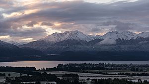
Lake Te Anau is the largest lake in New Zealand's South Island. It is the second largest lake in the whole country, after Lake Taupō. The Kepler and Murchison mountain ranges rise on the west side of Lake Te Anau. You can see these mountains from most of the town.
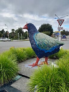
Many types of native birds live in the area. The Department of Conservation (DOC) has an office in Te Anau. They work hard to protect endangered native birds, like the Takahē.
Climate
| Climate data for Te Anau, elevation 560 m (1,840 ft), (1981–2010) | |||||||||||||
|---|---|---|---|---|---|---|---|---|---|---|---|---|---|
| Month | Jan | Feb | Mar | Apr | May | Jun | Jul | Aug | Sep | Oct | Nov | Dec | Year |
| Mean daily maximum °C (°F) | 20.0 (68.0) |
20.1 (68.2) |
18.1 (64.6) |
15.1 (59.2) |
11.7 (53.1) |
8.9 (48.0) |
8.4 (47.1) |
10.4 (50.7) |
13.0 (55.4) |
14.9 (58.8) |
17.1 (62.8) |
19.0 (66.2) |
14.7 (58.5) |
| Daily mean °C (°F) | 14.8 (58.6) |
14.6 (58.3) |
12.7 (54.9) |
10.4 (50.7) |
7.6 (45.7) |
5.3 (41.5) |
4.8 (40.6) |
6.0 (42.8) |
8.1 (46.6) |
9.7 (49.5) |
11.6 (52.9) |
13.5 (56.3) |
9.9 (49.9) |
| Mean daily minimum °C (°F) | 9.5 (49.1) |
9.1 (48.4) |
7.3 (45.1) |
5.7 (42.3) |
3.5 (38.3) |
1.8 (35.2) |
1.1 (34.0) |
1.6 (34.9) |
3.3 (37.9) |
4.5 (40.1) |
6.2 (43.2) |
8.0 (46.4) |
5.1 (41.2) |
| Average rainfall mm (inches) | 165.3 (6.51) |
91.9 (3.62) |
104.8 (4.13) |
80.3 (3.16) |
90.8 (3.57) |
112.1 (4.41) |
82.7 (3.26) |
85.2 (3.35) |
73.4 (2.89) |
133.8 (5.27) |
74.5 (2.93) |
107.7 (4.24) |
1,202.5 (47.34) |
| Mean monthly sunshine hours | 177.0 | 167.9 | 141.9 | 126.8 | 83.4 | 63.5 | 59.8 | 111.7 | 136.4 | 172.1 | 183.4 | 169.8 | 1,593.7 |
| Source: NIWA | |||||||||||||
Fun Things to Do in Te Anau
Fiordland Vintage Machinery Museum
This museum shows off Te Anau's early history. You can see old farm machines, a blacksmith shop, and even Te Anau's first school building. They have over 60 working tractors!
Hiking and Tramping
Te Anau is a great starting point for hikers. Many people begin the famous Milford Track from here. The Kepler Track is another popular hike. It is a 4-day loop that starts and ends right in Te Anau.
Kepler Challenge
Every December, Te Anau hosts the Kepler Challenge. This is a very tough running race that follows the Kepler Track.
Glowworm Caves
A popular attraction is the Te Ana-au Caves. These caves are across Lake Te Anau from the town. Inside, you can see an amazing underground glowworm grotto. You can view the glowworms from a small boat during guided tours.
Te Anau Bird Sanctuary
The Te Anau Bird Sanctuary, also called Punanga Manu o Te Anau, is on the southern shore of Lake Te Anau. Here you can see rare native birds like the takahē, kākā, Antipodes Island parakeets, and blue duck (whio).
Lake2Lake Trail
The Lake2Lake Trail is a cycling path. It starts in Te Anau and follows the Waiau River all the way to Lake Manapouri. The trail is 28.5 kilometres long.
Places to Visit in Te Anau
Fiordland Community Events Centre
The RealNZ Fiordland Community Events Centre has a large climbing wall. It also has indoor courts for sports like netball, basketball, volleyball, and badminton. There is a stage and meeting rooms too.
Te Anau Golf Club
The Te Anau Golf Club has an 18-hole golf course. It offers beautiful views of Lake Te Anau.
Perenuka Mountain Bike Park
This park has many different trails for mountain biking. It is a great place for riders of all skill levels.
Fiordland Community Swimming Pool
The Fiordland community swimming pool is an indoor pool. It is 25 metres long and heated, so you can swim all year round.
Education in Te Anau
Fiordland College is a high school for students aged 11 to 18 (years 7 to 13). It opened in 1976.
Te Anau School – Te Kura o Te Anau is a primary school for younger students (years 1 to 6). This school first opened in 1937.
Getting Around Te Anau
Te Anau has its own airport, Te Anau Airport. It is about 15 kilometres south of the town. There were plans to make the airport bigger to allow more flights and help tourism.
State Highway 94 is the main road connecting Te Anau to the rest of the South Island. This highway also goes all the way to Milford Sound.
Many private bus companies operate in Te Anau. They connect the town to places like Invercargill and Queenstown. They also go to smaller towns and popular hiking trails. Bus schedules often change with the seasons, with more buses running in summer. Many tour buses also pass through Te Anau on their way between Queenstown and Milford Sound.
The Southern Scenic Route is a special signposted road trip route. It travels through Te Anau, showing off some of the South Island's most beautiful places.
See also
 In Spanish: Te Anau para niños
 | Delilah Pierce |
 | Gordon Parks |
 | Augusta Savage |
 | Charles Ethan Porter |


