Southern Scenic Route facts for kids
Quick facts for kids
Southern Scenic Route |
|
|---|---|
 |
|
| Route information | |
| Maintained by NZ Transport Agency, Venture Southland, Destination Queenstown, Destination Fiordland, Clutha District Council, Dunedin City Council and Department of Conservation | |
| Length | 610 km (380 mi) |
| Existed | 6 November 1988–present |
| Major junctions | |
| West end | |
|
|
| East end | |
| Highway system | |
|
|
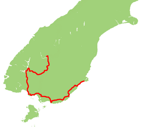
The Southern Scenic Route is a special road in New Zealand designed for tourists. It connects some amazing places in the South Island. Imagine a long, winding road that takes you from the adventure capital of Queenstown through the stunning Fiordland region, past Te Anau and the famous Milford Road. It then continues all the way to Dunedin, passing through towns like Riverton, Invercargill, and the beautiful area called The Catlins.
This route is known for its incredible scenery. In 2008, an Australian travel magazine even called it "one of the world's great undiscovered drives." It's a perfect way to explore the southern part of New Zealand and see its diverse landscapes, from mountains and lakes to rugged coastlines and forests.
Contents
Exploring the Southern Scenic Route
The Southern Scenic Route follows a U-shaped path across the lower South Island. It starts in Queenstown and ends in Dunedin. This journey is about 610 kilometers (379 miles) long. It's a great way to see many different parts of New Zealand.
Western Journey: Queenstown to the Coast
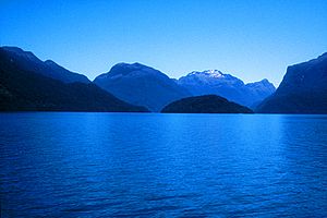
As you leave Queenstown, the route heads south. It goes along the edge of Fiordland National Park. This park is famous for its deep fiords and tall mountains. Along this part of the route, you'll pass through towns like Manapouri and Tuatapere.
Eventually, the road reaches the coast at Te Waewae Bay. Here, the route turns east. You'll drive through coastal towns such as Orepuki, Colac Bay, and Riverton. These towns offer beautiful ocean views and a chance to experience coastal life.
Central Section: Invercargill and Beyond
Near a place called Lorneville, the Southern Scenic Route joins the main New Zealand state highway network. It uses State Highway 6 for a short distance. This leads you right into Invercargill, which is the southernmost city in New Zealand.
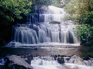
From Invercargill, the route continues eastward. You'll pass through Fortrose and enter the Catlins. This area is known for its wild coastline, native forests, and wildlife. You'll drive through Owaka before reaching Balclutha. This part of the route used to be called State Highway 92.
Eastern Stretch: Towards Dunedin
To avoid some difficult roads along the coast, the Southern Scenic Route then follows State Highway 1 (SH 1). This takes you through towns like Milton and past Lake Waihola.
The route leaves SH 1 at Waihola. It then climbs through the Otago Coast Forest. After this, it rejoins the coastline at Taieri Mouth. From here, you'll follow smaller roads through coastal communities. These include Brighton and Green Island. The Southern Scenic Route finally ends when it meets SH 1 again in Caversham, which is a suburb of Dunedin.
Who Manages the Route?
The Southern Scenic Route is looked after by several groups. These include the NZ Transport Agency, which manages many of New Zealand's roads. Other groups like Venture Southland, Destination Queenstown, and Destination Fiordland also help. Local councils, such as the Clutha District Council and Dunedin City Council, are involved too. Even the Department of Conservation helps, especially with areas near national parks. This teamwork helps keep the route in good condition for everyone to enjoy.
 | Jewel Prestage |
 | Ella Baker |
 | Fannie Lou Hamer |


