Doubtful Sound / Patea facts for kids
Quick facts for kids Doubtful Sound / Patea |
|
|---|---|
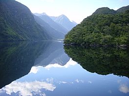
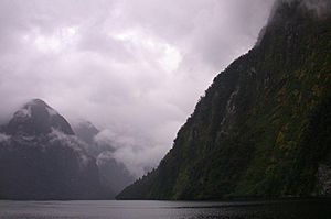
Doubtful Sound on a clear day
|
|
| Location | Fiordland |
| Coordinates | 45°19′S 166°59′E / 45.317°S 166.983°E |
| Native name | Patea Error {{native name checker}}: parameter value is malformed (help) |
| Part of | Tasman Sea |
| River sources | Elizabeth River |
| Basin countries | New Zealand |
| Max. length | 40 kilometres (25 mi) |
| Max. width | 2 kilometres (1.2 mi) |
| Islands | Bauza Island, Elizabeth Island |
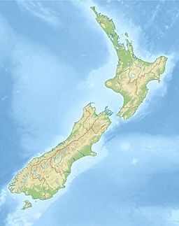
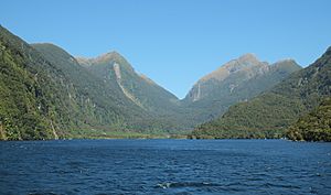
Doubtful Sound / Patea is a large fjord located in Fiordland, in the southwest of New Zealand. It is in the same area as the smaller but more famous Milford Sound. Doubtful Sound is considered one of New Zealand's top places to visit.
This fiord is about 40 kilometres (25 mi) long, making it the second longest in the South Island. It is also the deepest, reaching depths of up to 421 metres (1,381 ft). While its cliffs are not as tall as Milford Sound's, Doubtful Sound is wider and shows a clear U-shape, especially in its inner arms.
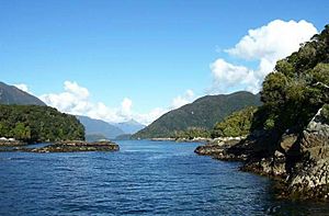
Like most of Fiordland, Doubtful Sound gets a lot of rain, usually between 3,000–6,000 millimetres (120–240 in) each year. The mountains around the fiord are covered in thick native rainforest.
Contents
A Look at Doubtful Sound's Past
Doubtful Sound was first called 'Doubtful Harbour' in 1770 by Captain Cook. He didn't sail into it because he wasn't sure if it was safe for his ship. Later, whalers and sealers renamed it Doubtful Sound. Even though it's called a "sound," it's actually a fjord.
In February 1793, a Spanish science team led by Alessandro Malaspina visited the fiord. They did experiments to measure gravity. The team's mapmakers, including Felipe Bauzá y Cañas, created the first map of the fiord's entrance. Many places there still have Spanish names today, like Febrero Point, Bauza Island, Pendulo Reach, and Malaspina Reach.
After a special law called the Ngai Tahu Claims Settlement Act 1998 was passed, the fiord's name was officially changed to Doubtful Sound / Patea.
Exploring the Geography
Doubtful Sound is deep inside Fiordland National Park. It's about 50 kilometres (31 mi) from the closest town, Manapouri. The area is surrounded by tall mountains, often reaching 1,300–1,600 metres (4,300–5,200 ft) high. There are no towns along the coast for about 200 kilometres (120 mi) in either direction.
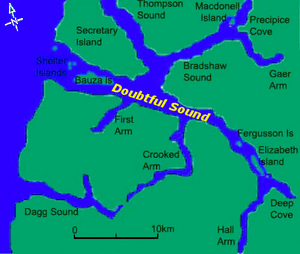
The sound has three main arms that stretch south from the main fiord:
- First Arm: This is the shortest, about 6 kilometres (3.7 mi) long.
- Crooked Arm: Located roughly halfway along the sound, it's the longest at 14 kilometres (8.7 mi).
- Hall Arm: This arm is 8 kilometres (5.0 mi) long and branches off near the end of the sound at Deep Cove.
Crooked Arm gets very close to Te Rā / Dagg Sound, almost cutting off a large piece of land.
Doubtful Sound is home to several big waterfalls. These include Helena Falls at Deep Cove and the Browne Falls, which drop over 600 metres (2,000 ft). During the rainy season, hundreds of waterfalls can be seen flowing down the steep hills.
The sound has about a dozen smaller islands. Some important ones are Elizabeth Island, Fergusson Island, Bauza Island, and the Shelter Islands. Part of the sound near Elizabeth Island is protected as the Taipari Roa (Elizabeth Island) Marine Reserve.
The part of the sound closest to the sea has many islands. The biggest is Secretary Island to the north. At the southern tip of Secretary Island, five bodies of water meet:
- The seaward end of Doubtful Sound, known as "The Gut"
- Te Awa-o-Tū / Thompson Sound
- Kaikiekie / Bradshaw Sound
- The rest of Doubtful Sound leading to Deep Cove (Malaspina Reach)
- First Arm
"The Gut," a narrow, shallower area between Bauza Island and Secretary Island, is a calm spot. It's popular for fishing and a good place to find crayfish.
You can reach Doubtful Sound by boat from the sea or by driving on the isolated Wilmot Pass road from the Manapouri Power Station. Most areas of the sound can only be reached by boat because there are very few roads or people living in this part of New Zealand.
Amazing Plants and Animals
Doubtful Sound has two special layers of water that don't mix much. The top layer, about 2–10 metres (5–35 ft) deep, is fresh water mixed with a little seawater. This layer gets fresh water from the rain and rivers, and it's stained brown by natural chemicals from the forest. The water released from the Manapouri Power Station also affects this layer. Below it is a layer of warmer, saltier seawater.
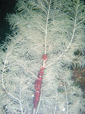
The dark brown fresh water on top blocks sunlight. This means that many deep-sea creatures can live in the shallower parts of the sound. For example, black coral Antipathes fiordensis usually grows at depths of 30–40 metres (100–130 ft), but in Doubtful Sound, you can find it at just 10 metres (35 ft). This makes it possible for trained divers to see it.
The land around Doubtful Sound is mostly steep and covered in thick forest. Nothofagus trees are common, and you can find many shrubs and ferns, like the crown fern, growing underneath.
The fiord is home to one of the southernmost groups of bottlenose dolphins. This group has only about 70 dolphins, and they tend to stay within the sound. They are very close-knit, partly because their home is colder than other dolphin habitats and has that special freshwater layer. Recently, there's been worry that their numbers are decreasing, with fewer baby dolphins surviving. Scientists are studying if increased tourism or the freshwater from the power station might be reasons for this.
Other wildlife in Doubtful Sound includes fur seals and penguins. You might even see large whales like Southern right whales and humpback whales. Sometimes, minke whales, sperm whales, and some giant beaked whales are spotted. Orcas (killer whales) and long-finned pilot whales also visit. The waters are full of sea creatures like fish, starfish, sea anemones, and corals. The sound is also an Important Bird Area because Fiordland penguins breed here. Secretary Island and Bauza Island are important safe places for rare birds in New Zealand.
How Hydroelectricity Affects the Sound
Deep Cove (45°27′S 167°09′E / 45.450°S 167.150°E), at the very end of Doubtful Sound, is where water from the Manapouri Power Station is released. Deep Cove is a special and mostly untouched natural area. The release of clear fresh water has changed some of the plants and animals by letting more light into the lower parts of the sound. However, this area naturally gets a lot of fresh water from rain (about 7.6 metres (24 ft 11 in) annually).
The small dock at Deep Cove is sometimes used to unload very large equipment for the Manapouri Power Station. This equipment is too big to be taken across Lake Manapouri. From Deep Cove, it is then moved over Wilmot Pass to the power station.
Visiting Doubtful Sound
Unlike Milford Sound, you cannot drive directly to Doubtful Sound. The Wilmot Pass road only connects the Manapouri Hydro Power Station to Deep Cove and is not part of the public road network.
The only way for visitors to see Doubtful Sound is by boat. Most tours start from the small town of Manapouri. These day trips involve a boat ride across Lake Manapouri, followed by a bus trip on a gravel road over Wilmot Pass to Deep Cove. There, you board a tour boat to explore Doubtful Sound. Tour companies offer both day trips and overnight options.
See also
 In Spanish: Doubtful Sound para niños
 | Toni Morrison |
 | Barack Obama |
 | Martin Luther King Jr. |
 | Ralph Bunche |


