Kapuka, New Zealand facts for kids
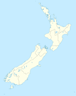
Kapuka is a small place, or "locality," located in the Southland region of New Zealand. You can find it on the South Island, which is one of New Zealand's two main islands. Kapuka sits between Mokotua and Ashers, right on the Southern Scenic Route. To its north is Oteramika, and to the south are places like Kapuka South, Waituna Lagoon, and Toetoes Bay.
What Kapuka is Known For
Kapuka is a rural area, so farming is a very important part of its economy. Farmers here raise dairy cattle to produce milk. Scientists have even done experiments in Kapuka to help cows make more milk. They tried adding genes from European Holstein cows to improve milk output.
There are also large amounts of lignite coal under the ground near Kapuka. Lignite is a type of soft coal. The Ashers-Waituna coalfield in this area holds about 746 tonnes of coal that could be dug up. People have looked into mining this coal, but no big mining operations have started yet.
Kapuka's Railway History
Kapuka once had its own railway station! On March 1, 1895, a train line called the Seaward Bush Branch was extended. It went from Mokotua all the way to Gorge Road, and Kapuka got a station along the way. For a short time, the station was even called Oteramika.
At first, trains from Invercargill only came to Kapuka a couple of times a week. But in 1899, the line was extended further to Waimahaka. After that, "mixed trains" started running daily through Kapuka. A mixed train carries both passengers and goods.
However, the railway started to lose money in the 1930s. To save costs, the mixed train service was cut to just once a week in 1951. On other days, only trains carrying goods ran. By June 1, 1960, all passenger trains stopped running through Kapuka. The amount of goods being sent by train also stayed low, so the entire railway line closed down on March 31, 1966. Today, you can still see parts of the old railway path near Kapuka.
 | Jewel Prestage |
 | Ella Baker |
 | Fannie Lou Hamer |


