Otago facts for kids
Quick facts for kids
Otago
Ōtākou (Māori)
|
||
|---|---|---|
|
Region
|
||
| Otago Region | ||
|
||
 Otago within New Zealand
|
||
| Country | New Zealand | |
| Island | South Island | |
| Established | 1848 (Dunedin settlement) 1852 (Otago Province) |
|
| Seat | Dunedin | |
| Territorial authorities |
List
Queenstown-Lakes District
Central Otago District Dunedin City Clutha District Waitaki District (40.39%) |
|
| Government | ||
| • Body | Otago Regional Council | |
| Area | ||
| • Region | 31,251 km2 (12,066 sq mi) | |
| • Land | 31,186.16 km2 (12,041.04 sq mi) | |
| Population
(June 2023)
|
||
| • Region | 254,600 | |
| • Density | 8.1469/km2 (21.100/sq mi) | |
| GDP | ||
| • Total | NZ$ 15.336 billion (2021) (6th) | |
| • Per capita | NZ$ 62,518 (2021) | |
| Time zone | UTC+12:00 (NZST) | |
| • Summer (DST) | UTC+13:00 (NZDT) | |
| HDI (2022) | 0.936 very high · 6th |
|
| Website | www.otago.co.nz www.orc.govt.nz |
|
Otago is a large and beautiful region in the southern part of New Zealand's South Island. It is managed by the Otago Regional Council. The region covers about 32,000 square kilometers, making it the second-biggest local government region in the country. In 2018, its population was around 225,186 people.
The name "Otago" comes from the local Māori language dialect. It is a different way to say "Ōtākou", which is the name of a Māori village near the entrance to Otago Harbour. The exact meaning of the name is debated. Some people think it means "isolated village," while others believe it means "place of red earth." This second meaning refers to the reddish clay found around Dunedin.
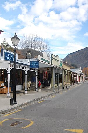
Dunedin is the main city in Otago. Other important towns include Oamaru, Balclutha, Alexandra, and the popular tourist spots Queenstown and Wānaka. Otago is also known for its hydroelectric power, which comes from the Waitaki and Clutha rivers. You can also find many vineyards and wineries in the Central Otago wine region.
Contents
History of Otago
Otago was first settled by the Māori people, just like the rest of New Zealand. Most Māori settlements in Otago were along the coast, especially around the Otago Peninsula.
European Settlement and the Gold Rush
European settlement in Otago began in March 1848. The first immigrant ships, the John Wickliffe and the Philip Laing, arrived from Scotland. These settlers were part of the Free Church of Scotland. Captain William Cargill, a former soldier, was their leader. He later became the first Superintendent of the Otago Province in 1853.
The Otago Province was once very large, covering all of New Zealand south of the Waitaki River. This included areas that are now part of the Southland Region.
Early European settlements focused on the port and city of Dunedin. They then spread southwest to the Taieri Plains, which had good farmland. A big change happened in the 1860s when Gabriel Read discovered gold at Gabriel's Gully near Lawrence. This started the famous Otago gold rush.
Many people from around the world, including gold miners from California and Australia, came to Otago. This changed the region's Scottish character. More gold was found at Clyde and near Arrowtown. This led to a huge boom, and Otago became a very important cultural and economic center in New Zealand for a while. New Zealand's first daily newspaper, the Otago Daily Times, started during this exciting time.
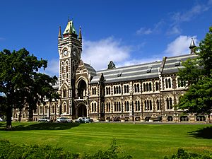
New Zealand's first university, the University of Otago, was founded in Dunedin in 1869.
Changes in Government
In 1861, the Southland Province separated from Otago and formed its own government. However, it rejoined Otago in 1870 after facing difficulties. In 1876, the provincial governments were removed and replaced by other local councils. Otago's flag was chosen in 2004, designed by Gregor Macauly.
Geography of Otago
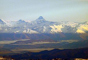
Otago's landscape is very diverse, starting with high mountains in the west. The highest peak in Otago is Mount Aspiring / Tititea, which is part of the Main Divide.
Rivers and Lakes
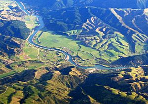
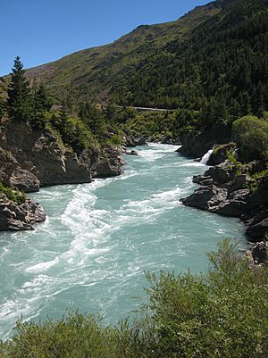
From the high mountains, large rivers flow into big glacial lakes. These lakes, like Wakatipu, Wānaka, and Hāwea, are the sources of the Clutha River / Mata-Au. The Clutha is New Zealand's largest river by the amount of water it carries. It flows southeast through Otago and empties into the Pacific Ocean near Balclutha. The river is used to create hydroelectricity with large dams at Clyde and Roxburgh.
The Taieri, New Zealand's fourth-longest river, also starts and ends in Otago. It forms two important features: the wide Strath-Taieri valley in its upper parts and the rich Taieri Plains closer to the ocean.
Central Otago and the Coast
East of the mountains, you'll find the drylands of Central Otago. This area has unique "block mountains" made of schist rock. Towns like Alexandra and Cromwell are located in the valleys between these mountains.
The Maniototo Plain, east of Central Otago, is a high plateau. It's not very populated but was important during the gold rush. Towns like Ranfurly and Naseby are here.
In the southeastern part of Otago is The Catlins, an area of hilly country. It has ancient Triassic and Jurassic rocks, and fossils can be found there.
Climate in Otago
Otago has two main types of climate: a coastal climate and a more continental climate inland.
Coastal Climate
Coastal areas of Otago have changing weather. They often experience warm, dry periods followed by cool, wet ones. Storms from the south bring irregular weather cycles, usually with a few days of fine weather followed by cooler, damp conditions.
Winters on the coast are generally cool and wet, especially in the far south. Snow can sometimes fall at sea level in winter, particularly in the hills of South Otago. Summers are usually warm and dry, with temperatures often reaching the high 20s or low 30s Celsius.
Inland Climate
Central Otago has a climate that is very similar to a continental climate. This means it has cold, frosty winters and hot, dry summers. It is one of the driest regions in New Zealand because high mountains to the west block most of the rain.
Summers in Central Otago can be very hot, often reaching or going above 30 degrees Celsius. Winters, however, are very cold. The town of Ranfurly holds the New Zealand record for the lowest temperature ever recorded: -25.6°C on July 18, 1903. This unique climate is why the Central Otago wine region is so successful.
Population of Otago
The Otago Region covers about 31,186 square kilometers. As of 2018, its population was around 225,186 people. This means there are about 7.2 people per square kilometer. About 60% of the region's population lives in the Dunedin urban area, which is the main city and New Zealand's sixth-largest urban area. Dunedin is considered one of New Zealand's four main centers. Its population has grown since the 1970s, largely because of the University of Otago, which attracts students from all over.
Other important towns in Otago with over 1,000 people include Queenstown, Oamaru, Wānaka, Cromwell, Alexandra, and Balclutha. The population of the Queenstown-Lakes District grew by 60% between 1996 and 2006, thanks to the booming tourism industry there.
In the 2023 New Zealand census, Otago's population was 240,900. This was an increase of 7.0% since the 2018 census. The median age was 38.4 years. About 15.7% of people were under 15 years old, and 17.7% were 65 or older.
People in Otago come from many different backgrounds. Most people (85.2%) identify as European (Pākehā). About 9.9% are Māori, and 8.5% are Asian. English is spoken by most people (97.5%), while 1.9% speak Māori language.
Many people in Otago have Scottish roots, as early settlers in the 19th century were from Scotland. Other European groups include people of English, Irish, and Dutch descent. A large part of the Māori population belongs to the Ngāi Tahu tribe. Other groups include people from Asia, the Pacific Islands, Africa, Latin America, and the Middle East. Historically, there were also Chinese and Lebanese settlers during the gold rush.
Economy of Otago
Otago has a diverse economy. In 2020, its economy was valued at about NZ$14.18 billion.
Key Industries
- Manufacturing and Technology: Dunedin is a center for manufacturing, publishing, and technology companies.
- Farming: Rural areas have seen a boost in recent years. Many sheep farms in the Clutha district have changed to more profitable dairy farming.
- Wine Industry: The New Zealand wine industry has grown quickly since the mid-1990s. The Central Otago wine region is famous for its wines, especially Pinot noir. They also grow grapes like Chardonnay, Sauvignon blanc, Merlot, and Riesling. Central Otago is becoming known as New Zealand's top Pinot noir region.
Education in Otago
Otago has many schools, from small primary schools in the countryside to larger schools in Dunedin. Most are state schools, meaning they don't charge tuition for local students. There are also "state integrated" schools, which used to be private but are now part of the public system. These schools often have a special character, like a religious belief, and may charge small "attendance dues."
Because Dunedin was founded by Scottish settlers who were Presbyterian, there are Presbyterian girls' and boys' schools in the city. Unlike other major cities in New Zealand, Dunedin does not have private intermediate or high schools that are not integrated into the state system.
See also
 In Spanish: Región de Otago para niños
 | DeHart Hubbard |
 | Wilma Rudolph |
 | Jesse Owens |
 | Jackie Joyner-Kersee |
 | Major Taylor |


