South Otago facts for kids
South Otago is a special part of the South Island of New Zealand. It's located in the southeast and is the most southern area of the larger Otago region.
The exact edges of South Otago are not super clear. It's not defined by political lines, but more by its natural features like hills and rivers, and how its communities are similar. This area covers about 8,000 square kilometers and is home to around 20,000 people. The Clutha District, with its main town Balclutha, is often thought of as South Otago. However, some areas like the Taieri Plains and coastal parts near Brighton have been part of Dunedin City since 1989. The southwestern part of the Clutha District, around Tapanui and Clinton, is known as West Otago.
Contents
Geography of South Otago

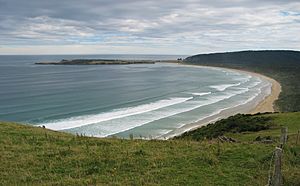
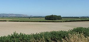
South Otago has three main types of land: thick forests, rolling hills, and flat river plains. In the south, you'll find the wild bush country of the Catlins. This area has beautiful forests and a rugged coastline. North of the Catlins, the land is mostly rolling hills. These hills are cut through by the flat, fertile plains of several large rivers.
Most of South Otago is not very populated. This is because of its cold winters, being a bit isolated, and not having a good port. An old port called Port Molyneux, near the mouth of the Clutha River, was closed in the early 1900s. This happened because it became easier and cheaper to move goods by train to and from Dunedin.
Rivers and Lakes
Many rivers flow through South Otago. The biggest is the Clutha / Matau-Au. It's New Zealand's second longest river, flowing 340 kilometers from Lake Wānaka in Central Otago. It passes through Balclutha, which means "Town on the banks of the Clyde" in Scots Gaelic. Near the ocean, the river splits into two around a large island called Inch Clutha before reaching the Pacific Ocean. A smaller river, the Tuapeka River, flows into the Clutha. This river was important as the starting point of the 1860s Central Otago Gold Rush near Lawrence.
Another important river is the Taieri, New Zealand's fourth longest. It winds through rough hills before forming the flat Taieri Plains northeast of Milton. Then it cuts through coastal hills to reach the ocean at Taieri Mouth. Lakes Waihola, Mahinerangi, and Waipori are also in South Otago. Their water eventually flows into the Taieri River through its branch, the Waipori River.
Between the Clutha and Taieri rivers is the smaller Tokomairaro River. This river drains the area around Milton.
Towns of South Otago
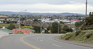
The largest town in South Otago is Balclutha. It's about 81 kilometers south of Dunedin by road. Balclutha is the main service town for the many farms in the area. In 2006, Balclutha had a population of 4,062 people.
Other towns in South Otago include:
- Milton (population 1,887)
- Kaitangata (population 810)
- Brighton
- Lawrence (population 432)
- Owaka (population 327)
- Stirling (population 309)
- Waihola
- Outram
- Allanton
- Henley
- Momona
- Kaka Point (population 201)
- Taieri Mouth
- Benhar (population 96)
For a time in the 1980s, Balclutha was known as New Zealand's wealthiest town per person.
History of South Otago
South Otago has a rich past. The original people were the Māori, and later, many settlers from Scotland arrived in the 1840s and 1850s. Like in most of the South Island, these settlers bought land from the Māori. Later, the main Māori tribe from the area, Kai Tahu, received a large payment from the New Zealand Government. This was to make up for land that was taken during the time of settlement.
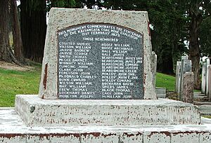
The Central Otago Gold Rush in the 1860s brought thousands of people to the area, hoping to find gold. This rush first started around Lawrence. The discovery of coal in Kaitangata was also very important for the region's growth. Sadly, a coal mine explosion in Kaitangata in 1879 was one of Otago's worst disasters. Other minerals found in South Otago include silica and phosphate.
More recently, the region has been known for wool processing and forestry. Farmers here raise sheep, dairy cattle, and deer. Farming and related businesses are the main way people make a living in South Otago. Tourism, especially around the Catlins, is also becoming more important for the region's economy.
South Otago's connection with Dunedin has grown stronger since local government areas were changed in the 1980s. The northern part of South Otago, including much of the Taieri Plains, is now part of Dunedin City. The rest of the area is almost entirely within the Clutha District. Dunedin International Airport is located at Momona in South Otago. It's a key transport hub, even though most people using it are just passing through on their way to or from Dunedin. South Otago is also home to Lake Mahinerangi, which is Dunedin's most important water supply. It's located near the top of Maungatua.
People of South Otago
People living in South Otago and Southland have a unique accent. It's different from the rest of New Zealand, with a rolling 'r' sound. This probably comes from the Scots Gaelic roots of many residents. You can also see this in the many place names that come from Scots Gaelic and Lallans Scots. The people are known for being friendly and welcoming, but also a bit cautious of new people.
The main high schools in the area are South Otago High School in Balclutha and Tokomairiro High School in Milton.
Notable residents
- Ken Bloxham (rugby player)
- Amy Bock (con artist)
- Tony Brown (rugby player)
- James Edward Fulton (surveyor and civil engineer)
- Frank Oliver (rugby player)
- Daryl Tuffey (cricketer)
- Hone Tuwhare (poet)
- John Joseph Woods (writer of the music for New Zealand's national anthem, God Defend New Zealand)
 | Valerie Thomas |
 | Frederick McKinley Jones |
 | George Edward Alcorn Jr. |
 | Thomas Mensah |


