Henley, New Zealand facts for kids
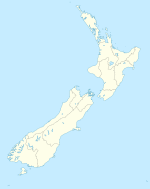
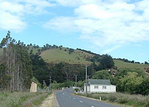
Henley is a small town located on the Taieri Plains in New Zealand. It was named after Henley-on-Thames, a famous rowing town in England. Henley sits near where the Taieri River and Waipori River meet, at the edge of the plain. It's also close to some low hills by the coast.
This town is special because it's very near the Sinclair Wetlands. These wetlands are an important natural area, located about 3.5 kilometers (2.2 miles) to the west. Henley is also close to Lake Waihola, which is a popular spot for rowing. About 250 people live in Henley. The town was first settled before the year 1880.
Contents
Exploring Henley's Location
Henley is found at the southwestern edge of the city of Dunedin. It is about 35 kilometers (22 miles) from the center of Dunedin. The town's original Māori name is Maitapapa. Long ago, before Europeans arrived, a Māori settlement was located south of Henley, close to the Taieri River.
Life and Work in Henley
The main type of work in Henley is dairy farming. This means people raise cows to produce milk. Henley used to have its own cheese factory. This factory later moved to a nearby town called Momona. Eventually, a bigger company bought it, which became known as Mainland Cheese. The town also has two churches: a Presbyterian church and a Brethren church.
Understanding Flooding in Henley
Henley is a town that can sometimes get flooded by the Taieri River. New Zealand State Highway 1 (SH1) is a main road built on a raised bank. This bank helps protect the wider Henley area from floods, so it's often called "The flood-free highway."
Henley's main road runs mostly next to and south of this highway. These two roads connect at Titri in the south and at Otokia in the north. There is also a connecting road that crosses a bridge over the Taieri River, right in the middle of Henley.
The 1980 Flood Event
In June 1980, the South Taieri region experienced very bad floods. The water covered both sides of the highway. It even reached as far as Dunedin International Airport in Momona. Several things caused this big flood. The wetlands around Lake Waihola were already full of water. Both the Taieri and Waipori Rivers flow into this area, adding more water. Also, a lot of water was released from the Lake Mahinerangi dam at that time. All this extra water put huge pressure on the river banks, causing them to break and flood the land.
 | Laphonza Butler |
 | Daisy Bates |
 | Elizabeth Piper Ensley |


