
Otago Harbour facts for kids
Quick facts for kids Otago Harbour |
|
|---|---|
 |
|

Otago Harbour
Location in Otago peninsula
|
|
| Location | Dunedin, Otago, New Zealand |
| Coordinates | 45°49′54″S 170°37′46″E / 45.8317°S 170.6294°E |
| River sources | Water of Leith and Toitū Stream |
| Ocean/sea sources | South Pacific Ocean |
| Basin countries | New Zealand |
| Max. length | 21 kilometres (13 mi) |
| Islands | Quarantine Island, Goat Island / Rakiriri, and Pudding Island |
| Settlements | Dunedin and Port Chalmers |
Otago Harbour is a natural harbour in Dunedin, New Zealand. It's a long, curvy stretch of water. It separates the Otago Peninsula from the main land. The harbour is about 21 kilometres (13 miles) long. It stretches from the ocean to the city of Dunedin.
It has two important ports: Port Chalmers and Dunedin's main wharf. For about 700 years, this harbour has been very important. It has been a safe place for fishing and ships.
Contents
Discovering Otago Harbour's Geography
Otago Harbour was formed a long, long time ago. It's actually the remains of a huge volcano! This volcano was centred near what is now Port Chalmers. You can still see the dark, volcanic rocks in the hills around the harbour. The last time the volcano erupted was about ten million years ago. This created the tall Mount Cargill.
The main shipping channel runs along the western side of the harbour. The eastern side is quite shallow. It has large sandbanks that show up at low tide. There are two islands in the harbour: Goat Island / Rakiriri and Quarantine Island/Kamau Taurua. They are located between Port Chalmers and Portobello. A smaller island, Pudding Island (Titeramoa), is close to the peninsula shore. You can even walk to it when the tide is low.
The Water of Leith river flows into the harbour at its southern end. Many other small streams also flow into the harbour. This makes the harbour water a bit less salty than the open ocean.


Amazing Wildlife of Otago Harbour
Just like the Otago Peninsula, the harbour waters are home to many rare animals.
Seabirds of the Harbour
The harbour area is a great place for many types of wading birds. Other birds that visit include two kinds of penguins. These are the little penguin and the famous yellow-eyed penguin. At Taiaroa Head, which is the very tip of the Otago Peninsula, you can find the only "mainland" colony of northern royal albatrosses in the world.
Marine Mammals in the Water
The harbour and peninsula are vital homes for Hooker's sea lions and New Zealand fur seals. Sometimes, larger seals like southern elephant seals and leopard seals visit the harbour. In total, four types of seals and at least nine kinds of whales and dolphins live in or travel through this area.
The outer peninsula is one of the main gathering spots for dusky dolphins in New Zealand. The harbour and peninsula are important places for them to breed and raise their young. Bottlenose dolphins and the very rare Hector's dolphins also visit these waters often. Other species like common dolphins and orcas can be seen near the harbour entrance. Orcas and dusky dolphins have even been seen interacting peacefully here.
In the past, Southern right whales used to come inside the harbour. They would use the shallow, calm water to nurse their babies. But commercial whaling almost made them disappear. Now, the number of humpback whales visiting the peninsula is growing. This species is recovering much faster than the southern rights. People have also seen blue whales, minke whales, and long-finned pilot whales here.
History of Otago Harbour

The Māori people first came to Otago Harbour in the 1300s. This was soon after they first settled in New Zealand. It was too far south to grow sweet potatoes. So, they became hunter-gatherers. At first, they hunted seals and fished in the harbour. Later, they focused more on fishing as seal numbers went down. Māori place names, like Kamau Taurua (Quarantine Island), tell us about this history. Kamau Taurua means "a place where nets are set."
First European Ships Arrive

Captain Cook sailed near Otago Harbour in 1770. He thought a harbour might be there, but he never entered it. We don't know exactly when the first Europeans arrived. They were likely sealers. Māori stories say it was "long before" 1810.
Written records from this time are few. They are mostly journals or newspaper stories from sailors who stayed only a short time. The American ship Favorite might have visited in 1805 or 1806. The London sealing ship Unity probably visited in 1808 or 1809. Its Chief Officer, Charles Hooper, likely gave his name to Hoopers Inlet on the Otago Peninsula.
William Tucker was a settler who was at Otago Harbour on May 3, 1810. This is the first clear record of a European ship in the harbour. The court record from 1810 calls the harbour 'Port Daniel'. This name was used for some years.
Seal Hunters and Whalers
Another English sealing ship, the Sydney Cove, was in the harbour in late 1810. A Māori chief named Te Wahia took a knife and some other items. This led to a conflict called "The Sealers' War" or the 'War of the Shirt'.

In December 1817, James Kelly of Hobart anchored his ship Sophia in the harbour. William Tucker was on board. Tucker had been living at nearby Whareakeake (Murdering Beach) since 1815. He and two other men were killed there. Kelly then took revenge on Māori people on his ship in the harbour. He also burned a village by the harbour.
Peace was made in 1823. On July 17, 1823, John Rodolphus Kent of the ship Mermaid named the harbour "Port Oxley". He named it after the Surveyor General of the Colony, John Oxley. But as we know, it already had names. In 1826, Thomas Shepherd explored the area where Dunedin is now. He left the oldest pictures of the harbour.
Otago Harbour started as a secret place for seal hunters. Then it became a busy international whaling port. The Weller brothers set up their whaling station at Te Umu Kuri, Wellers Rock, in November 1831. This is now called Otakou. It became the busiest whaling port south of the Bay of Islands. By 1839, whaling had declined. Dumont D'Urville visited in 1840. He saw that the port had become a centre for trading alcohol. This continued until Scottish settlers arrived in 1848. They made Port Chalmers and Dunedin the main towns on the harbour.
Harbour Changes and Improvements

Otago Harbour looks like a great deep-water port. But it wasn't naturally perfect for large ships, especially when they needed to dock close to the city. The flat land at the southern end was perfect for Dunedin. But the harbour itself was only deep enough for big ships as far as Port Chalmers. Beyond Port Chalmers, the harbour is shallow and muddy. Mudflats are often seen at low tide. In 1946, Otakou Fisheries started. It was based in the town of the same name on the eastern side. This later became a big part of the Otago fishing industry.
As Dunedin grew, especially after the Otago Gold Rush of the 1860s, people wanted ships to reach the city's wharves. It was a difficult and costly decision. But they agreed to dig a channel along the northwestern side of the harbour. This channel was officially opened on December 30, 1881. It was called the Victoria Channel.
The first channel was narrow and shallow. The first ship to use it, the SS Penguin, got stuck for a short time. A large area at the head of the harbour has been filled in since Dunedin was founded. This land is mostly used for factories and businesses. Smaller areas have also been filled in at Port Chalmers, Macandrew Bay, and Broad Bay.
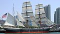
Over time, the channel was made wider and deeper. By 1907, twice as many ships used Dunedin's wharves as used Port Chalmers. In the early 1970s, Port Chalmers got a container port. Then the Victoria Channel became quieter again. Port Otago Ltd maintains the channel. They keep it dredged to a depth of eight metres. This allows ships up to 40,000 tonnes to travel up the harbour to Dunedin. Today, much of the channel's traffic is oil transport to Dunedin. It also carries chemicals and fertiliser to and from Ravensbourne's fertiliser works.
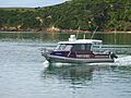
Aramoana at the harbour mouth was twice planned for New Zealand's second aluminium smelter. These plans were in the mid-1970s and early 1980s. But they were stopped after big public protests. The harbour has tides, is shallow, and is usually calm. Because of this, it's popular for water sports like yachting and windsurfing.
Harbour Facilities and Travel
Port Chalmers has large container port facilities. It is about 9 kilometres (6 miles) from the harbour mouth. A channel along the western side of the harbour is regularly dredged. This allows ships with a depth of 12.5 metres to reach Port Chalmers. Ships with an 8-metre depth can go all the way to Dunedin. New Zealand's frozen meat export trade started at Port Chalmers in 1882.
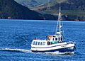
Portobello is home to one of New Zealand's top marine research centres. This is the Portobello Marine Laboratory. It is part of the University of Otago. It sits at the harbour's edge on a small arm of the Otago Peninsula. Today, you can charter many sightseeing and fishing boats. There is also a regular ferry from Port Chalmers to Portobello.
Harbourside Towns
Here are the towns around Otago Harbour, listed clockwise from the harbour mouth.
| Photo | Name | Harbour side | Population | Feature |
|---|---|---|---|---|
 |
Harington Point | East | ||
| Weller's Rock | East | Near the albatross colony, seal colony, and Fort Taiaroa | ||
 |
Otakou | East | Home of the Ōtākou Rūnanga of Ngāi Tahu and starting place of Otakou Fisheries. | |
| Harwood | East | |||
|
|
Portobello | East | 1110 | |
| Broad Bay | East | |||
 |
Macandrew Bay | East | 1146 | |
 |
Challis | East | ||
 |
Andersons Bay | East | 2478 | |
 |
Dunedin (Central City) | South | ||
|
|
Ravensbourne | West | 1230 | Fertiliser works |
| Saint Leonards | West | 780 | ||
|
|
Roseneath | West | ||
|
|
Sawyers Bay | West | 1212 | With a tannery |
 |
Port Chalmers | West | 1365 | |
 |
Careys Bay | West | ||
 |
Aramoana | West | 270 | Māori for "pathway to the sea" |
Images for kids
-
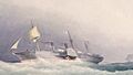
RMS Atrato (1853)
-
Dunedin (ship)
-
Endeavour (ship)
-
John Wickliffe (ship)
-
Mokoia (ship)
-
Monarch (ship)
-
Rainbow Warrior (2011)
-
Sootychaser (ferry)
-
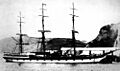
Star of India (ship)

.jpg)
.jpg)

.jpg)


