Portobello, New Zealand facts for kids
Quick facts for kids
Portobello
|
|
|---|---|
|
Settlement
|
|

Portobello
|
|
| Country | New Zealand |
| Island | South Island |
| Region | Otago |
| Community board | Otago Peninsula Community Board |
| Electorates |
|
| Area | |
| • Total | 1.97 km2 (0.76 sq mi) |
| Population
(2018 Census)
|
|
| • Total | 594 |
| • Density | 301.5/km2 (780.9/sq mi) |
| Time zone | UTC+12 (NZST) |
| • Summer (DST) | UTC+13 (NZDT) |
| Area code | 03 |
| Local iwi | Ngāi Tahu |
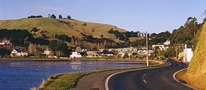
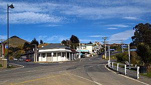
Portobello is a small village in New Zealand. It sits right next to the Otago Harbour, about halfway along the Otago Peninsula in Dunedin City. The village is located at the base of a smaller piece of land called the Portobello Peninsula. This peninsula is found between Portobello Bay and Latham Bay.
Portobello got its name from a place in Edinburgh, Scotland, which is also called Portobello. Many places in Dunedin share names with spots in Scotland.
Contents
Discover Portobello's Unique Features
At the very end of the Portobello Peninsula, you'll find a special place. It's a marine research station called the Portobello Marine Laboratory. This lab is part of the University of Otago. Scientists here study the ocean and its creatures.
Close to the marine lab is Quarantine Island / Kamau Taurua. This island has an interesting history.
What to See and Do in Portobello
Portobello has a few cool spots to visit. You can explore the Historical Society Museum to learn about the area's past. There's also the 1908 Restaurant if you're looking for a meal.
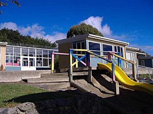
The village has its own primary school, Portobello School, for kids from Year 1 to 8. You'll also find the old Portobello Hotel (a pub), a cafe, and places to stay like a camping ground or motels. A local dairy (like a small grocery store) helps with daily needs.
Getting Around Portobello
The main road connecting Portobello to Dunedin city is called Portobello Road. It winds along the edge of the harbour. This road was recently improved and widened.
In 2023, a new 19-kilometer shared path was finished. It's called Te Aka Ōtākou. This path makes it safe for cyclists and walkers to travel between Portobello and Dunedin. You can even take a ferry from Portobello to Port Chalmers to complete a full loop around the harbour.
There's also a more scenic, but winding, route called Highcliff Road. It connects Portobello to Dunedin city centre by going over the top of the peninsula.
Boating and Community Life
Boating has always been important to Portobello. Long ago, people used to take a ferry to the city before Portobello Road was built. Today, you can still catch a ferry from the recently updated jetty. It goes to Kamau Taurua and Port Chalmers.
A local boating club keeps boats and a slipway near the jetty. This shows how much people in Portobello love being on the water.
The community also has a group called Portobello Community Inc. They work to make Portobello an even better place for everyone who lives there.
Portobello's Population and People
Portobello covers an area of about 1.97 square kilometers. It is part of a larger area called Broad Bay-Portobello.
In 2018, the village had a population of 594 people. This was an increase of 72 people since 2013. There were 237 homes in Portobello.
Most people in Portobello are of European background (94.4%). About 11.6% identify as Māori. A small number of people are from Pasifika (2.5%) or Asian (1.5%) backgrounds.
When asked about religion, most people (66.7%) said they had no religion. About 23.2% were Christian.
Learning at Portobello School
Portobello School is a primary school for boys and girls. It teaches children from Year 1 to Year 8. The school first opened its doors in 1857. As of February 2024 , it has a roll of 51 students.
 | Jewel Prestage |
 | Ella Baker |
 | Fannie Lou Hamer |


