Taiari / Chalky Inlet facts for kids
Quick facts for kids Taiari / Chalky Inlet |
|
|---|---|

Wreck of the GSS Stella Northport in Chalky Inlet
|
|
| Location | Tasman Sea |
| Coordinates | 45°58′48″S 166°38′03″E / 45.9801°S 166.6341°E |
| Native name | Taiari Error {{native name checker}}: parameter value is malformed (help) |
| River sources | Lumaluma Creek, Carrick River, Kohe Creek, Shallow Creek |
| Catchment area | 515 square kilometres (199 sq mi) |
| Basin countries | New Zealand |
| Max. length | 27.7 kilometres (17.2 mi) |
| Max. width | 2.3 kilometres (1.4 mi) |
| Surface area | 110 square kilometres (42 sq mi) |
| Average depth | 374 square kilometres (144 sq mi) |
| Islands | Chalky Island, Great Island, Little Island, Motutawaki, Small Craft Harbour Islands, Garden Islands |
| Sections/sub-basins | Moana-whenua-pōuri / Edwardson Sound, Te Korowhakaunu / Cunaris Sound, Eastern Passage, Western Passage, Return Channel |
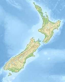
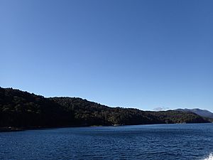
Taiari / Chalky Inlet is a beautiful fiord located in Fiordland, a special area in the southwest of New Zealand's South Island. It is part of the huge Fiordland National Park. This fiord is one of the southernmost ones in New Zealand.
Contents
Exploring Taiari / Chalky Inlet's Geography
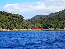
Taiari / Chalky Inlet has a very interesting shape. It's like a maze of water and land. There are two main ways to enter the fiord from the Tasman Sea. These are called the Eastern Passage and the Western Passage. A group of islands separates these two entrances.
One important island is Chalky Island. It's the closest island to the open sea. Both the island and the fiord got their English names from the white cliffs on the island's southern side. In Māori, Chalky Island is called Te Kākahu-o-Tamatea. This name comes from a story about an explorer named Tamatea who laid his cloak, or kākahu, there to dry.
Further inside the fiord are the Passage Islands. The biggest of these is Motutawaki. Its Māori name means 'island of large penguins', like the Fiordland penguin. Even further in is Great Island, also known as Ōteauau. It's the largest island in the fiord, covering about 7.36 square kilometers. Great Island has two small lakes, Lakes Dobson and Esau. It also reaches 185 meters above sea level. This island is very important for protecting native animals because it has no possums. Little Island is a small island found between Great Island and the mainland.
There are also other small groups of islands. The Small Craft Harbour islands are about 15 kilometers from the fiord's mouth. The Garden islands are closer to the mouth, on the eastern side.
About 15 kilometers from the sea, Taiari / Chalky Inlet splits into two smaller fiords. One part is called Moana-whenua-pōuri / Edwardson Sound. It continues in a north-south direction. The other part is Te Korowhakaunu / Cunaris Sound, which runs east-west. The land between these two fiords is called Divide Head. Its Māori name is Te Tapuwae-o-Māui, meaning 'the footstep of Māui'.
Te Korowhakaunu / Cunaris Sound
Te Korowhakaunu / Cunaris Sound stretches for about 10.3 kilometers. It goes from the Dark Cloud Range towards the main part of Taiari / Chalky Inlet. This fiord is a bit shallower than the main fiord. Its deepest point is 323 meters, while the main fiord goes down to 374 meters.
At its end, the fiord splits into two smaller coves. The northern cove, Islet Cove, gets water from the Carrick River. This is one of the biggest rivers flowing into the fiord system. The other cove is Cliff Cove. This cove is very close to a neighboring fiord called Rakituma / Preservation Inlet. Only about 500 meters of land separates them.
The land south of Cunaris Sound is called the Dark Cloud Range. It reaches a height of 1043 meters at Treble Mountain. The name Cunaris Sound might come from a French word for 'canary'. This is because songbirds like mōhua (yellowheads) were common here long ago.
Moana-whenua-pōuri / Edwardson Sound
Moana-whenua-pōuri / Edwardson Sound runs north to south, just like the main part of Taiari. It starts about 10 kilometers from where it meets Te Korowhakaunu. On its western side, the Kakapo Range runs alongside the fiord. This range reaches 1130 meters high at a peak called The Stopper.
At the very end of this fiord is a calm area called Lake Cove. Two main streams flow into this cove. Cora Lynn Falls brings water from a series of lakes, including Purser, Carrick, and Cadman. Lumaluma Creek also flows into Lake Cove, draining a large area with many small mountain lakes called tarns. Many other small creeks flow into the fiord, especially when it rains.
Moana-whenua-pōuri is much shallower than the other parts of the Taiari fiord. Unlike many other fiords, it gets shallower as you go further in. The upper parts of this fiord are only about 60 meters deep.
History of Taiari / Chalky Inlet
We don't know much about how Māori lived in Fiordland before Europeans arrived. The area was tough to live in all the time. However, Māori explored the area for hunting and gathering resources like pounamu (greenstone) about 800 years ago. Later, in the 1700s, some of the iwi (tribes) like Kāti Māmoe moved into the area.
Captain James Cook was the first European to see Taiari / Chalky Inlet. This was during his second voyage in 1773. He named the fiord and Chalky Island after the white cliffs he saw. Cook didn't go into the fiord because of bad weather.
The first Europeans to explore inside the fiord arrived in 1813. A small ship called the Snapper entered the fiord. Its crew set up a camp for several months in Edwardson Sound. They named it after their captain, Captain Edwardson. When Captain Edwardson returned in 1820, he noticed big changes. Lake Cove, which was once too shallow for ships, had become a deep harbor.
After this, Europeans visited the area for both money-making and scientific reasons. Sealers and whalers came often in the 1820s and 1830s. But they hunted so many seals and whales that there were hardly any left. So, these activities stopped quickly. The area was also surveyed by ships like the HMS Acheron around 1850. They looked for valuable resources like granite and coal. There was even a short gold rush in a nearby fiord in the 1880s, but it didn't spread to Taiari / Chalky Inlet.
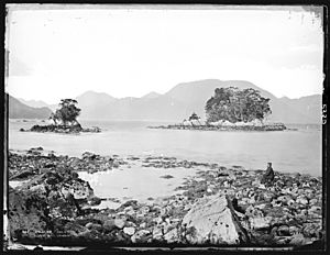
At the same time, people also explored the land. Alfred Henry Burton, a photographer from Dunedin, took many pictures of Fiordland. His photos showed how beautiful and untouched the area was. These pictures helped convince people to protect the area. It became a "National reserve" in 1904, which later became part of the National Park.
Taiari / Chalky Inlet has remained mostly untouched because it's so isolated. You can't reach it by land, only by sea or air. In recent years, efforts have been made to bring back Māori cultural history. In 2019, many fiords, including Chalky Inlet, were given dual Māori and English names, like Taiari / Chalky Inlet.
Protecting Taiari / Chalky Inlet's Wildlife
In recent years, people have worked hard to protect the environment of Taiari / Chalky Inlet. A study in 1977 found many unwanted species, like deer, that were harming the area. More recently, in 2019, an invasive seaweed called Undaria was found. People are working to remove it.
Great efforts have been made to remove pests from the islands in Taiari / Chalky Inlet. Great Island, the Passage Islands (including Motutawaki), and Chalky Island are now free of pests. This has allowed these islands to become safe places for many native animals. Since 2002, native species have been brought back to these islands. These include the mōhua (yellowhead), orange-fronted kākāriki, little spotted kiwi, and tīeke (saddleback).
Chalky Island is also home to a special lizard called the Te Kakahu skink. This skink was discovered in 2002 and was confirmed as a unique species in 2011. The fiord also has evidence of many petrel bird colonies, just like other fiords in the area.
 | Calvin Brent |
 | Walter T. Bailey |
 | Martha Cassell Thompson |
 | Alberta Jeannette Cassell |


