Te Houhou / George Sound facts for kids
Quick facts for kids Te Houhou / George Sound |
|
|---|---|
| Location | Tasman Sea |
| Coordinates | 44°51′00″S 167°21′00″E / 44.850°S 167.35°E |
| Native name | Te Houhou Error {{native name checker}}: parameter value is malformed (help) |
| River sources | George River, Whitewater River, Edith River. |
| Basin countries | New Zealand |
| Max. length | 26 kilometres (16 mi) |
| Max. width | 1,500 metres (1,600 yd) |
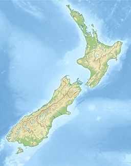
Te Houhou / George Sound is a long, narrow inlet of the sea, also known as a fiord. It is found on the South Island of New Zealand. This amazing natural feature is one of many fiords that make up the beautiful coastline of Fiordland.
Contents
What is Te Houhou / George Sound?
Te Houhou / George Sound is a type of valley carved by glaciers. These valleys then filled with seawater. It is located in the northern part of the Fiordland coast. This fiord sits between Taitetimu / Caswell Sound and Hāwea / Bligh Sound.
How Big is George Sound?
Te Houhou / George Sound is quite large. It stretches for about 26 kilometres (16 mi) in length. At its widest point, it is over 1,500 metres (1,600 yd) across. This makes it the longest fiord in the northern Fiordland area. The fiord generally runs in a northwest direction.
Parts of the Fiord
The fiord has a couple of main sections that branch off. There is the Southwest Arm, which is located in the southern part. Halfway along the northeastern side, you will find Anchorage Cove. These areas add to the unique shape of the fiord.
Rivers Flowing into the Sound
Several rivers flow into Te Houhou / George Sound. The biggest ones are the George River, the Whitewater River, and the Edith River.
- The George River empties into Anchorage Cove. This is about halfway along the fiord's northeast coast.
- The Whitewater River enters the fiord on its southwest coast. It is almost directly opposite the mouth of Anchorage Cove.
- The Edith River and a smaller stream called Katherine Creek both flow into the southeastern end of the fiord. The Edith River flows through Lake Alice. It then tumbles over the 56-metre (184 ft) Alice Falls into the fiord's waters.
Walking Tracks Nearby
There is a walking track that starts near the mouth of Katherine Creek. This track connects to Lake Hankinson. Lake Hankinson is close to the top of Lake Te Anau. The track goes over a place called the Henry Pass.
How Did Te Houhou / George Sound Get its Name?
The name of the fiord has an interesting history. A. W. Reed wrote a famous book about New Zealand place names in 1975. He shared two possible reasons for the name "George Sound."
Possible Origins of the Name
- One idea is that it was named after a ship. This ship was called the King George. It was commanded by Captain S. Chase.
- However, it is more likely that the fiord was named after George Stevens. He was the pilot of a ship called HMS Acheron.
Official Name Change
In October 2019, the fiord's name was officially changed. It is now known as Te Houhou / George Sound. This new name includes both the Māori name "Te Houhou" and the English name "George Sound."
 | Janet Taylor Pickett |
 | Synthia Saint James |
 | Howardena Pindell |
 | Faith Ringgold |


