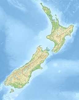
Taiporoporo / Charles Sound facts for kids
Quick facts for kids Taiporoporo / Charles Sound |
|
|---|---|
| Location | Tasman Sea |
| Coordinates | 45°03′00″S 167°04′59″E / 45.05°S 167.083°E |
| Native name | Taiporoporo Error {{native name checker}}: parameter value is malformed (help) |
| River sources | Irene River, Windward River |
| Basin countries | New Zealand |
| Max. length | 14 kilometres (8.7 mi) |
| Max. width | 1 kilometre (0.62 mi) |
Taiporoporo / Charles Sound is a long, narrow inlet of the sea, called a fiord, located in the South Island of New Zealand. It is one of many beautiful fiords that make up the coast of a region known as Fiordland.
Contents
What is Taiporoporo / Charles Sound Like?
Taiporoporo / Charles Sound is found along the central coast of Fiordland. It sits between two other fiords: Taitetimu / Caswell Sound and Hinenui / Nancy Sound. This fiord stretches for about 14 kilometres (about 9 miles). It generally runs towards the northwest.
Exploring the Fiord's Arms
As you go further into the fiord, it splits into two main branches. These branches are almost the same length. The northern branch is called the Emelius Arm. The southern branch is known as the Gold Arm.
Protected Areas in the Fiord
The Gold Arm is a special place. It is protected as the Kahukura (Gold Arm) Marine Reserve. This means its marine life and environment are kept safe. Other parts of the fiord are also protected. They are included in the Taumoana (Five Fingers Peninsula) Marine Reserve. These reserves help protect the unique plants and animals that live here.
Rivers and Islands of the Sound
Two rivers flow into the ends of the fiord's arms. The Irene River flows into the Emelius Arm. The Windward River flows into the Gold Arm. A shorter river, the Juno River, enters the Tasman Sea just north of the fiord's entrance.
You can also find several small islands inside the fiord. Catherine Island and Fanny Island are in the Gold Arm. Eleanor Island is located at the mouth of the Emelius Arm.
How Did Taiporoporo / Charles Sound Get Its Name?
In the early to mid-1800s, this fiord was known as Charlie's Sound. It was very likely named after a man named Charles MacLaren. He was the captain of a ship called the Sydney Cove. This ship visited the sound in 1810. It was a sealing boat, meaning it was used to hunt seals.
In October 2019, the official name of the fiord was changed. It became Taiporoporo / Charles Sound. This new name includes both the Māori name and the historical English name.
What Happened During the 2003 Earthquake?
On August 23, 2003, a strong earthquake hit Fiordland. It had a magnitude of 7.0. This earthquake caused a large landslide. The landslide crashed into Charles Sound. This created a huge wave, known as a tsunami. The tsunami was about 4 to 5 metres (13 to 16 feet) high. It caused damage to a wharf and a helipad in the sound.
 | Selma Burke |
 | Pauline Powell Burns |
 | Frederick J. Brown |
 | Robert Blackburn |


