Tamatea / Dusky Sound facts for kids
Quick facts for kids Tamatea / Dusky Sound |
|
|---|---|

Tamatea / Dusky Sound
|
|
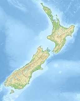
| Location | Tasman Sea |
| Coordinates | 45°44′57″S 166°47′12″E / 45.7492°S 166.7866°E |
| Native name | Tamatea Error {{native name checker}}: parameter value is malformed (help) |
| River sources | Mike River, Seaforth River, Shag River |
| Basin countries | New Zealand |
| Max. length | 40 km (25 mi) |
| Max. width | 8 km (5.0 mi) |
| Islands | Anchor Island, Cooper Island, Indian Island, Long Island. |
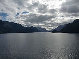
Tamatea / Dusky Sound is a beautiful and large fiord located in the southwest part of New Zealand. It's found within the amazing Fiordland National Park. A fiord is like a long, narrow arm of the sea, reaching far inland, often with steep cliffs on either side.
Contents
Exploring Tamatea / Dusky Sound
Tamatea / Dusky Sound is one of the biggest and most complex fiords on New Zealand's coast. It stretches about 40 kilometers (25 miles) long and is up to 8 kilometers (5 miles) wide.
Islands and Waterfalls
To the north of the fiord's entrance is a large island called Resolution Island. This island helps protect the entrance of the sound. Along the east side of Resolution Island, a passage called Acheron Passage connects Tamatea / Dusky Sound to another fiord, Te Puaitaha / Breaksea Sound, which is to the north.
Many islands are found inside the sound, including Anchor Island, Long Island, and Cooper Island. The inner parts of the sound have very steep sides. Because it rains a lot in this area, hundreds of waterfalls tumble down into the sound, especially during the rainy season.
Wildlife in the Sound
You can often spot seals and dolphins playing in the waters of Tamatea / Dusky Sound. Sometimes, even whales visit! This area, especially near Preservation Inlet, was once a place where people hunted southern right whales from the shore. Now, the number of humpback whales visiting the area is increasing. The Seaforth River is the biggest of many small rivers and streams that flow into the sound.
The Mouth of the Sound
At its entrance, the sound is wide. It's bordered by the Five Fingers Peninsula to the north and by South Cape and Fannin Bay to the south. West Cape, the westernmost point of New Zealand's South Island, is less than 10 kilometers (6 miles) south of the sound's mouth.
Right inside the entrance, you'll find the large Anchor Island and many smaller islands. These include groups like the Seal, Petrel, and Many Islands. North of Anchor Island is Resolution Island. Its coast here has a large triangular cove that separates the Five Fingers Peninsula from the rest of the island. Many small coves, like Goose Cove and Earshell Cove, are along this coast. Just southeast of Anchor Island is the smaller Indian Island.
Channels and Inner Parts
East of Anchor Island, the sound becomes narrower, about five kilometers (3 miles) wide. It then splits into two wide channels, separated by Long Island. This island is about 15 kilometers (9 miles) long but only about 2 kilometers (1.2 miles) wide at its widest point.
The narrower channel, Cook Channel, is south of Long Island. Bowen Channel is to the north. Bowen Channel connects with Acheron Passage, which runs north-south and separates Resolution Island from the mainland. This passage also links to Te Puaitaha / Breaksea Sound to the north.
Further inland from Long Island is Cooper Island, which is about eight kilometers (5 miles) long and up to five kilometers (3 miles) wide. Tamatea / Dusky Sound gets even narrower east of Cooper Island. It ends in two small coves, Shark Cove and Supper Cove. The Seaforth River flows into the eastern end of Supper Cove.
Important Bird Area for Fiordland Penguins
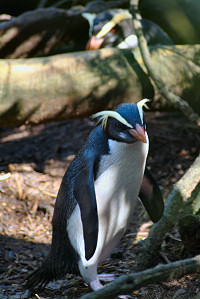
Tamatea / Dusky Sound is recognized as an Important Bird Area by BirdLife International. This means it's a very special place for birds, especially because it's where Fiordland penguins come to breed and raise their chicks.
History of Tamatea / Dusky Sound
It's believed that the Māori sometimes camped by the sound's waters long ago, before Europeans arrived, when they were hunting moa (a large, now extinct, bird).
Early European Visits
The entrance to the fiord was first seen by Europeans in 1770 by Captain Cook during his first journey to New Zealand. He named it Dusky Bay. On his second journey, he spent two months exploring the sound. He used it as a safe harbor, setting up workshops and an observatory. It's thought that his crew made the first beer in New Zealand during their stay! He met some Māori people and had friendly interactions with them.
Captain Cook saw Dusky Sound as a good harbor for ships sailing into the Pacific from Europe. This made it seem very important in the early days of European exploration.
Sealers and Early Settlements
Tamatea / Dusky Sound was used by other European sailors and merchant ships in the late 1700s and early 1800s. From 1792, it became a popular spot for seal hunters.
In 1792, men from Captain William Raven's ship, the Britannia, built the first European house in New Zealand here. They also built the first ship in Australasia (the region including Australia and New Zealand). The first European woman known to have visited New Zealand was recorded here in 1793. In 1795, a group of 244 Europeans, including two women named Elizabeth Bason and Ann Carey, were stranded in Dusky Sound. They were the first known European women to live ashore in New Zealand. The last of this group left in 1797.
Sealers moved their focus to Bass Strait from 1798 but returned to New Zealand, at Dusky Sound, in 1802. In that year, Captain Charles Bishop and George Bass spent 14 days in Dusky Sound. They took iron from an old ship and a blacksmith turned it into axes. They then used these axes in Tahiti to trade for pork. Sealers continued to visit the sound until the late 1820s.
Modern Name Change
In December 2019, the official name of the fiord was changed to Tamatea / Dusky Sound. This new name includes both the Māori name "Tamatea" and the European name "Dusky Sound."
How to Get to Tamatea / Dusky Sound
You can only reach Tamatea / Dusky Sound by sea or by air. There are no roads that go all the way to the coast at this point. However, a walking trail called the Dusky Track leads to the upper parts of the sound, at Supper Cove. This track starts from Lake Manapouri and Lake Hauroko.
 | Jessica Watkins |
 | Robert Henry Lawrence Jr. |
 | Mae Jemison |
 | Sian Proctor |
 | Guion Bluford |


