Contumazá facts for kids
Quick facts for kids
Contumazá
|
|
|---|---|
|
Village
|
|
 |
|
| Country | |
| Region | Cajamarca |
| Province | Contumazá |
| District | Contumazá |
| Elevation | 2,674 m (8,773 ft) |
| Time zone | UTC-5 (PET) |
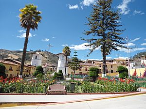
Contumazá is a town located in northern Peru. It is the capital of the Contumazá Province, which is part of the Cajamarca Region.
Contumazá's Climate
Contumazá has a special kind of weather called a subtropical highland climate. This means it has mild temperatures all year round. It also has clear wet and dry seasons.
Rainfall in Contumazá
The town gets about 727.1 millimeters (28.63 inches) of rain each year. Most of this rain falls during the wet season. This season usually lasts from January to April. March is the rainiest month, with about 230 millimeters of rain.
From May to November, Contumazá gets much less rain. July and August are the driest months, with almost no rainfall.
Temperatures in Contumazá
Temperatures in Contumazá stay pretty steady throughout the year. There are only small changes between months. During the dry season, the difference between day and night temperatures is bigger. Days are warmer, and nights are cooler.
The average high temperature for the year is 20.3°C (68.5°F). The average low temperature is 9.3°C (48.7°F).
| Climate data for Contumazá (1991–2020) | |||||||||||||
|---|---|---|---|---|---|---|---|---|---|---|---|---|---|
| Month | Jan | Feb | Mar | Apr | May | Jun | Jul | Aug | Sep | Oct | Nov | Dec | Year |
| Mean daily maximum °C (°F) | 19.2 (66.6) |
18.9 (66.0) |
19.0 (66.2) |
19.6 (67.3) |
20.7 (69.3) |
21.4 (70.5) |
21.5 (70.7) |
21.6 (70.9) |
21.2 (70.2) |
20.4 (68.7) |
20.1 (68.2) |
19.7 (67.5) |
20.3 (68.5) |
| Mean daily minimum °C (°F) | 9.9 (49.8) |
10.4 (50.7) |
10.6 (51.1) |
10.0 (50.0) |
9.0 (48.2) |
7.8 (46.0) |
7.5 (45.5) |
8.0 (46.4) |
9.0 (48.2) |
9.6 (49.3) |
9.3 (48.7) |
10.0 (50.0) |
9.3 (48.7) |
| Average precipitation mm (inches) | 78.5 (3.09) |
165.0 (6.50) |
231.6 (9.12) |
104.5 (4.11) |
24.7 (0.97) |
4.9 (0.19) |
1.4 (0.06) |
1.2 (0.05) |
9.2 (0.36) |
24.4 (0.96) |
28.7 (1.13) |
53.0 (2.09) |
727.1 (28.63) |
| Source: NOAA | |||||||||||||
See also
 In Spanish: Contumazá para niños
 | James B. Knighten |
 | Azellia White |
 | Willa Brown |


