Coonoor, New Zealand facts for kids
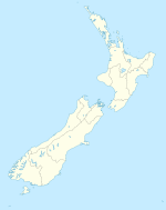
Coonoor is a small area in New Zealand where people mostly raise sheep. It's located in the northern part of a region called the Wairarapa. Coonoor is about 38 kilometers (24 miles) south-east of a town called Dannevirke. It's also about 48 kilometers (30 miles) north-east of Pahiatua.
The name Coonoor first came from one of the big sheep farms in the area. Later, it became the name for the whole district and a small school there. Coonoor is special because it sits at a spot where four roads meet.
Exploring Coonoor's Roads
Coonoor is like a crossroads, with different paths leading to interesting places. Each road connects Coonoor to other towns and regions.
Roads Leading to Nearby Towns
One road from Coonoor goes straight to Dannevirke. This road crosses the border between the Wellington and Hawke's Bay areas. Another main road leads to Pahiatua. You would travel through a place called Makuri on this route. Makuri has always been a bigger community than Coonoor. It has more people and is home to several social and sports clubs.
Roads to the East Coast and Beyond
A third road from Coonoor crosses the Puketoi Range. This is a range of hills. This road takes you to places like Horoeka, Waione, and Pongaroa. These towns are closer to the East Coast of New Zealand.
The fourth road is known as the Makairo Track. This track is no longer open for cars or trucks. It used to head towards Woodville, which is between Dannevirke and Pahiatua. Today, this narrow and winding road is a popular path for people who love mountain biking. It offers a great adventure for cyclists.


