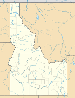
Corral, Idaho facts for kids
Quick facts for kids
Corral
|
|
|---|---|
| Country | United States |
| State | Idaho |
| County | Camas |
| Elevation | 5,098 ft (1,554 m) |
| Time zone | UTC-7 (Mountain (MST)) |
| • Summer (DST) | UTC-6 (MDT) |
| ZIP codes |
83322
|
| GNIS feature ID | 372129 |
Corral is a small, unincorporated community in southwestern Camas County, Idaho, United States. An unincorporated community means it's a place with a shared identity but no local government like a city or town.
It is located along U.S. Route 20, which is a major highway. Corral lies west of Fairfield, which is the main town and county seat of Camas County. The land here is about 5,098 feet (1,554 meters) above sea level. Even though Corral is not a city, it has its own post office with the ZIP code 83322.
History of Corral
People started settling in the area now known as Corral around 1886.
On November 30, 1886, a person named Robert L. Hicks transferred some land on Corral Creek to H.F. McCarter. McCarter and his family then moved to this property and began farming there.
By 1891, a school was built on the property. This first school building was later taken down to make way for two new school buildings.
The number of people living in Corral has changed over time. In 1909, about 40 people lived there. By 1960, the estimated population was around 20 people.
Corral's Climate
The weather in Corral has big changes between seasons. Summers are usually warm to hot, and sometimes humid. Winters are cold, and can even be very cold.
According to a system called the Köppen Climate Classification, Corral has a "humid continental climate." This type of climate is often shown as "Dfb" on climate maps. It means the area experiences all four seasons, with warm summers and cold, snowy winters.
 | Toni Morrison |
 | Barack Obama |
 | Martin Luther King Jr. |
 | Ralph Bunche |


