Cossatot River State Park-Natural Area facts for kids
Quick facts for kids Cossatot River State Park-Natural Area |
|
|---|---|

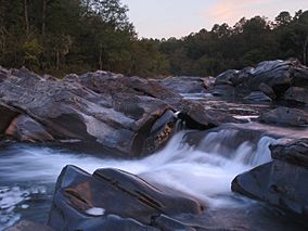
Cossatot River
|
|
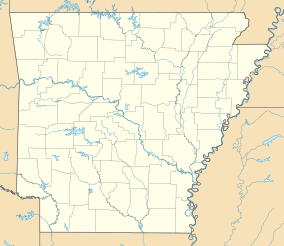
| Location | Wickes, Ouachita Mountains, Arkansas, United States |
| Area | 5,299.65 acres (21.4469 km2) |
| Established | February 19, 1988 |
| Named for | Cossatot River |
| Governing body | Arkansas Department of Parks and Tourism, Arkansas Natural Heritage Commission |
| Website | Cossatot River State Park-Natural Arkansas |
The Cossatot River State Park-Natural Area is a special place in Arkansas, USA. It covers about 5,300 acres (over 2,100 hectares) in Howard County and Polk County. This park protects a wild, undeveloped 12.5-mile (20 km) stretch of the Cossatot River.
The Cossatot River is famous for its exciting whitewater rapids. It's part of Arkansas's Natural and Scenic Rivers System and the National Wild and Scenic Rivers System. This means it's a protected river known for its natural beauty and outdoor fun. The river has Class III, IV, and even dangerous Class V rapids. These are very challenging sections of the river. Because of these rapids, the park is a popular spot for skilled canoeists, kayakers, and playboaters. The park became part of the state park system in 1988. It is managed by the Arkansas Department of Parks and Tourism and the Arkansas Natural Heritage Commission.
Contents
How the Park Was Created
The idea for Cossatot River State Park started in 1975. The Arkansas Natural Heritage Commission wanted to protect the wild land along the Cossatot River. At that time, a company called Weyerhaeuser owned the land.
Weyerhaeuser liked the idea but worried about how to manage the river's dangerous rapids. They wanted to make sure visitors would be safe. In 1984, the Arkansas Department of Parks and Tourism joined the plan. They offered to work with the Commission to buy the land. This helped Weyerhaeuser feel better about the park's safety.
After a meeting, a group called The Nature Conservancy held the land. They kept it safe until the state had enough money to buy it for the park. Even today, the park is managed by both the Department of Parks and Tourism and the Natural Heritage Commission. The park grew even bigger when Arkla Gas Company donated 160 acres (65 hectares) of land. They gave this land in exchange for building a gas pipeline across the Cossatot River.
Fun Things to Do at the Park
The Cossatot River is known for its challenging rapids. It's one of the toughest rivers for floating in the central United States. The rapids are rated Class III, IV, and even dangerous Class V. This means they are very difficult and exciting for experienced paddlers.
River Access and Camping
At the Brushy Creek Recreation Area, you can find restrooms and picnic tables. You can also get to the river from here using the Highway 246 bridge. If you want to stay overnight, there are campsites available.
- Cossatot Falls Area has 7 campsites.
- Sandbar Area has 14 campsites.
- Ed Banks Area has one campsite.
None of these campsites have electric or water hookups, so it's a true outdoor experience!
Exploring Nature
The park is home to many rare plants and animals. Some of these are found only in the Ouachita Mountains and the nearby Ouachita National Forest. The park's land is a rugged, rocky canyon. It has old, tall hardwood trees and areas with juniper plants.
You can go hiking on two main trails:
- The River Corridor Trail is 14 miles (22.5 km) long.
- The Harris Creek Trail is 3.5 miles (5.6 km) long.
Visitor Center Activities
The park has a visitor's center that was built in 2004. Inside, you can find a special room for watching wildlife. There's also a water education laboratory where you can learn about the river. And if you want a souvenir, there's a gift shop too!
 | Delilah Pierce |
 | Gordon Parks |
 | Augusta Savage |
 | Charles Ethan Porter |


