County of Maramie facts for kids
Maramie County was a special area in Queensland, Australia, that existed a long time ago, before the year 1901. It was like a historical division of land. This county was named after a type of crayfish found in the local area.
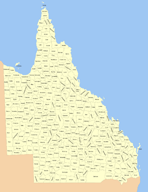
You could find Maramie County in a place called Far North Queensland. This is a northern part of Australia, specifically on the lower section of the Cape York Peninsula. It was located about 130 kilometers (or 81 miles) south-east of a town called Kowanyama. Like other counties, Maramie County was further divided into smaller sections called civil parishes.
Contents
What Was a County?
Before 1901, Queensland used a system of "counties" to help organize its land. These counties were not like the local government areas we have today. Instead, they were more like large, mapped-out sections of land.
The main purpose of these counties was to help with land administration. This means they helped the government keep track of who owned land and how it was being used. They were important for things like surveying and selling land.
Where Was Maramie County?
Maramie County was located in a very interesting part of Australia. It was in Far North Queensland, which is known for its unique wildlife and beautiful landscapes. The county was situated on the lower part of the Cape York Peninsula.
The Cape York Peninsula is a large, remote area that stretches far north. It is famous for its rainforests, rivers, and coastal areas. Being in this region meant Maramie County was part of a wild and often undeveloped landscape in the late 1800s.
Why the Name "Maramie"?
The name "Maramie" comes from a local word. It refers to a type of crayfish that lives in the area. This shows how early land divisions often took their names from natural features or local Indigenous languages. It connects the land directly to its environment and history.
History of Queensland's Counties
The system of counties in Queensland began in the 1800s. It was part of how the British colonial government organized the new lands they were settling. Each county was given a name, often after important people or local features.
However, this system of counties changed over time. After Australia became a federation in 1901, the way land was managed also evolved. The counties became less important for daily administration. While they still exist on some historical maps, they are no longer used for modern land management.
From Counties to Modern Divisions
Today, Queensland uses different ways to divide its land. We have local government areas, which are run by councils. These councils manage services for the people living there. We also have electorates for voting.
The old county system, like Maramie County, represents an earlier way of organizing the land. It shows how Australia's geography was understood and divided in the past. It's a piece of history that helps us understand the development of the state.
Civil Parishes
Within Maramie County, there were smaller divisions called "civil parishes." These parishes were even smaller sections of land. They were mainly used for very detailed land records.
Think of it like this: a state is divided into regions, regions into counties, and counties into parishes. This layered system helped to precisely identify every piece of land. It was crucial for legal documents and land sales back then.
 | Chris Smalls |
 | Fred Hampton |
 | Ralph Abernathy |


