Coxs Creek, Kentucky facts for kids
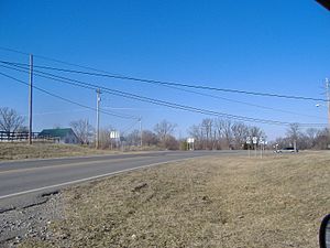
Coxs Creek is a small, unincorporated community located in Nelson County, Kentucky. An "unincorporated community" means it's a group of homes and businesses that isn't officially a town or city with its own local government. Coxs Creek is found along important roads, U.S. Routes 31E and 150, which locals often call Louisville Road. This community is about 4.5 miles north of Bardstown, the main town in Nelson County.
Contents
A Look Back in Time
Coxs Creek is named after Colonel Isaac Cox, who came from Pennsylvania. In April 1775, before the American Revolutionary War began, Isaac Cox and his brother James built a "fort" here. This wasn't a big military fort, but more like a strong, old-fashioned "block house." It was a safe place for pioneers to live.
The First Pioneer Station
The land where Coxs Creek is located originally belonged to Isaac's father, David Cox. However, David moved back to Virginia before he could develop it. Isaac Cox's settlement, which covered about 1,000 acres (or 4 square kilometers), was known as the first "pioneer station" in Nelson County. A pioneer station was a small settlement or outpost built by early settlers in new territories. Sadly, Isaac Cox was later the last white person to be killed by Native Americans during the time of the great Indian wars in what would become Kentucky.
Early Community Life
Coxs Creek also played an important role in the early history of religion in Kentucky. The state's second Baptist association, a group of Baptist churches working together, was formed right here in Coxs Creek on October 29, 1785.
The community got its first post office on November 28, 1856. John C. Cox, a descendant of Isaac Cox, was the very first postmaster. Years later, when cars became common, the original post office building and a nearby store were blocking the view for drivers on US-31. Because of this, the Kentucky Highway Department ordered the post office to move in the 1960s. The new post office is now about half a mile south of the main crossroads of US-31E/US-150 and Kentucky State Route 509.
Geography and Modern Day
The community of Coxs Creek is also named after the nearby creek, which flows into Kentucky's Salt River. The land in Coxs Creek is generally hilly, with elevations ranging from about 650 to 736 feet (or 198 to 224 meters) above sea level.
Today, Coxs Creek has one school, Cox's Creek Elementary School. If you look at a map, its location is 37.899 degrees North latitude and 85.474 degrees West longitude. The ZIP Code for Coxs Creek is 40013.
 | Delilah Pierce |
 | Gordon Parks |
 | Augusta Savage |
 | Charles Ethan Porter |


