Crag Gill facts for kids
Quick facts for kids Crag Gill |
|
|---|---|
| Location | Teesdale, North East, England |
| Area | 2.3 ha (5.7 acres) |
| Established | 1984 |
| Governing body | Natural England |
| Website | Map of site |
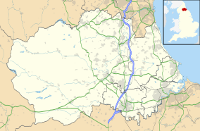
Crag Gill is a special natural area in County Durham, England. It's known as a Site of Special Scientific Interest (SSSI). This means the area is protected because it has important plants, animals, or geological features. Crag Gill is located in the Teesdale area, about 3 kilometers (about 2 miles) east of a village called Eggleston. A road, the B6282, runs nearby and separates Crag Gill from another SSSI called Bollihope, Pikestone, Eggleston and Woodland Fells.
What Makes Crag Gill Special?
Crag Gill is important because of its rocks. It shows layers of rock that formed a very long time ago. These rocks are from a period called the Namurian. This was a time when the Earth's climate was different, and these rocks tell us a lot about that period.
Types of Rocks You Can Find
The rocks at Crag Gill are a mix of:
- Limestone: This rock often forms from the shells and skeletons of sea creatures.
- Sandstone: This rock is made from grains of sand cemented together.
- Shale: This is a soft, layered rock made from mud and clay.
These different layers of rock are part of what geologists call a "Yoredale-type sequence." This pattern of rock layers helps scientists understand how the land changed over millions of years.
The Whitestone Limestone
Crag Gill is especially famous for a specific rock layer called the Whitestone limestone. This layer is so unique and clear that it's known as a "type locality." This means it's the best example of this particular rock layer. Scientists use it as a "marker horizon" to help them identify and understand other rock layers from the Namurian period in different places. It's like a special signpost in the Earth's history!


