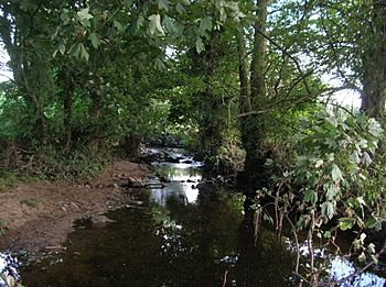
Crimple Beck facts for kids
Quick facts for kids Crimple Beck |
|
|---|---|

Crimple near Pannal
|
|
|
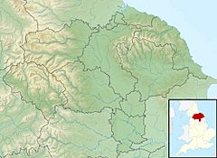
Location of the mouth within North Yorkshire
|
|
| Other name(s) | River Crimple |
| Country | England |
| County | North Yorkshire |
| Physical characteristics | |
| Main source | Stainburn Moor |
| River mouth | River Nidd 53°58′20″N 1°23′01″W / 53.972113°N 1.383731°W |
| Length | 24.9 km (15.5 mi) |
| Basin features | |
| Basin size | 80 km2 (31 sq mi) |
The Crimple Beck (also called the River Crimple) is a small river or stream in North Yorkshire, England. It flows into the River Nidd, joining it near the towns of Little Ribston and Walshford. The Crimple Beck is about 24.9 kilometers (15.5 miles) long. Its water comes from an area of 80 square kilometers (31 square miles) around Harrogate. One of its smaller streams is called the Park Beck.
Where Does the Crimple Beck Flow?
The Crimple Beck starts on the hills of Stainburn Moor, close to Beckwithshaw. From there, it flows east and meets another stream called Nor Beck. It then passes through the villages of Burn Bridge and Pannal.
The beck continues flowing northeast. It goes under the A61 road and the famous Crimple Viaduct, which is a large railway bridge just south of Harrogate. When it meets the Rud Brook, it changes direction and flows southeast. It then connects with the Park Brook before reaching Spofforth, where the A661 road crosses over it.
After Spofforth, the beck keeps flowing until it reaches a place called Blackstones. Here, its flow is measured. Finally, the Crimple Beck joins the River Nidd between Little Ribston and Walshford.
How We Measure the Water Flow
The amount of water flowing in the Crimple Beck is measured at two special places called gauging stations.
- The first station is near Burn Bridge, higher up the beck. It has been measuring the water since 1972. The area that drains into the beck at this point is about 8.1 square kilometers (3.1 square miles). The average flow here is about 0.11 cubic meters per second.
- The second station is near Blackstones, closer to where the beck joins the River Nidd. This station started measuring in 1991. The area draining into the beck by this point is much larger, about 76.8 square kilometers (29.7 square miles). Because of this, the average flow here is higher, about 1.02 cubic meters per second.
The highest water level ever recorded at the Blackstones station was on December 26, 2015, when the water reached 2.98 meters (9.8 feet) high. The area around the beck gets about 752 millimeters (29.6 inches) of rain each year. The highest point in this area is 243 meters (797 feet) high on Stainburn Moor, which is where the beck begins.
Most of the land around the Crimple Beck is countryside, with fields for grass and crops, and some woodlands. There are also urban areas, like parts of Harrogate.
 | Dorothy Vaughan |
 | Charles Henry Turner |
 | Hildrus Poindexter |
 | Henry Cecil McBay |


