Crécy-en-Ponthieu facts for kids
Quick facts for kids
Crécy-en-Ponthieu
|
||
|---|---|---|

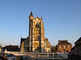
Church of Crécy-en-Ponthieu
|
||
|
||
| Country | France | |
| Region | Hauts-de-France | |
| Department | Somme | |
| Arrondissement | Abbeville | |
| Canton | Rue | |
| Intercommunality | CC Ponthieu-Marquenterre | |
| Area
1
|
56.55 km2 (21.83 sq mi) | |
| Population
(Jan. 2019)
|
1,370 | |
| • Density | 24.23/km2 (62.75/sq mi) | |
| Time zone | UTC+01:00 (CET) | |
| • Summer (DST) | UTC+02:00 (CEST) | |
| INSEE/Postal code |
80222 /80150
|
|
| Elevation | 19–82 m (62–269 ft) (avg. 36 m or 118 ft) |
|
| 1 French Land Register data, which excludes lakes, ponds, glaciers > 1 km2 (0.386 sq mi or 247 acres) and river estuaries. | ||
Crécy-en-Ponthieu is a small town in northern France. It is located in the Somme department, which is part of the Picardie region. The town is famous for its history and is found south of the city of Calais.
Crécy-en-Ponthieu gives its name to the large Crécy Forest. This forest starts about two kilometers southwest of the town. It is one of the biggest forests in northern France. A very small river, called the Maye, flows right through the town.
Contents
Discovering Crécy-en-Ponthieu's Past
Crécy-en-Ponthieu is best known for a very important battle that happened there.
The Famous Battle of Crécy (1346)
The most famous event in Crécy-en-Ponthieu's history is the Battle of Crécy. This battle took place in the year 1346. It was one of the first and most important battles of the Hundred Years' War. The Hundred Years' War was a long series of conflicts between England and France. This battle showed how powerful new weapons, like the English longbow, could be.
Ancient Roman Roads and World War II Airfields
Besides the famous battle, Crécy-en-Ponthieu has other interesting historical connections.
The Chaussée Brunehaut: An Ancient Road
Close to the town, you can still see an old Roman road called the Chaussée Brunehaut. This road was built by the Romans and connected important cities like Paris and Amiens to Boulogne. Even today, parts of this ancient road are still visible and you can walk on them.
A World War II Airfield
Just north of Crécy-en-Ponthieu, there was an airfield used during the Second World War. This shows that the area played a role in more recent history too.
See also
 In Spanish: Crécy-en-Ponthieu para niños
 | Toni Morrison |
 | Barack Obama |
 | Martin Luther King Jr. |
 | Ralph Bunche |


