Darlington Woods, Indiana facts for kids
Quick facts for kids
Darlington Woods, Indiana
|
|
|---|---|
| Country | United States |
| State | Indiana |
| County | Montgomery |
| Township | Franklin |
| Elevation | 784 ft (239 m) |
| Time zone | UTC-5 (Eastern (EST)) |
| • Summer (DST) | UTC-4 (EDT) |
| ZIP code |
47933
|
| Area code(s) | 765 |
| GNIS feature ID | 433319 |
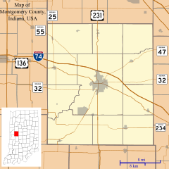
Darlington Woods is a quiet, rural area in Indiana. It is known as an unincorporated community. This means it is not a city or town with its own local government. Instead, it is part of a larger area called Franklin Township. Darlington Woods is located within Montgomery County.
History of Darlington Woods
Long ago, Darlington Woods was a very popular place for hunting. People from the nearby town of Darlington often came here. They hunted animals like deer, pheasants, quail, and rabbits. These animals were easy to find in the area.
A special old bridge, called the Darlington Covered Bridge, is found near the southern edge of Darlington Woods. This historic bridge was built in 1868.
Geography of Darlington Woods
Darlington Woods covers a specific area in Montgomery County. It is located east of County Road (CR) 400 East. The area stretches south from CR 570 North. It continues south to CR 400 North and CR 700 East.
 | Jackie Robinson |
 | Jack Johnson |
 | Althea Gibson |
 | Arthur Ashe |
 | Muhammad Ali |


