
Day Heights, Ohio facts for kids
Quick facts for kids
Day Heights, Ohio
|
|
|---|---|

Location of Day Heights, Ohio
|
|
| Country | United States |
| State | Ohio |
| County | Clermont |
| Township | Miami |
| Area | |
| • Total | 1.18 sq mi (3.05 km2) |
| • Land | 1.18 sq mi (3.05 km2) |
| • Water | 0.00 sq mi (0.00 km2) |
| Elevation | 866 ft (264 m) |
| Population
(2020)
|
|
| • Total | 2,625 |
| • Density | 2,228.35/sq mi (860.24/km2) |
| Time zone | UTC-5 (Eastern (EST)) |
| • Summer (DST) | UTC-4 (EDT) |
| ZIP code |
45150
|
| Area code(s) | 513 |
| FIPS code | 39-20366 |
| GNIS feature ID | 2393392 |
Day Heights is a community in Clermont County, Ohio, United States. It is known as a census-designated place (CDP). This means it is an area that the U.S. Census Bureau defines for gathering statistics. It is not an officially incorporated town or city.
In 2020, the population of Day Heights was 2,625 people.
Where is Day Heights?
Day Heights is located in the northwestern part of Clermont County, Ohio. It is south of Miami Township. Another community called Mount Repose is to its north.
Ohio State Route 131 runs through the middle of Day Heights. This road goes west about 3.5 miles (5.6 km) down a hill to the town of Milford. The big city of Cincinnati is about 19 miles (31 km) west of Day Heights.
The total area of Day Heights is about 1.18 square miles (3.05 square kilometers). All of this area is land.
Population Facts
| Historical population | |||
|---|---|---|---|
| Census | Pop. | %± | |
| 2020 | 2,625 | — | |
| U.S. Decennial Census | |||
According to the census from the year 2000, there were 2,823 people living in Day Heights. There were 1,006 households, which are groups of people living together in one home. Most of these were families.
The population was spread out by age. About 25.6% of the people were under 18 years old. About 11.3% were 65 years old or older. The average age of people in Day Heights was 39 years.
Pictures of Day Heights
-
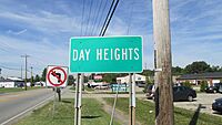
A sign welcoming you to the Day Heights community.
-
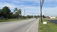
This picture shows Ohio Highway 131 looking west in Day Heights.


See also
 In Spanish: Day Heights (Ohio) para niños
