
Clermont County, Ohio facts for kids
Quick facts for kids
Clermont County
|
|||
|---|---|---|---|

Clermont Commission Building, Batavia
|
|||
|
|||

Location within the U.S. state of Ohio
|
|||
 Ohio's location within the U.S. |
|||
| Country | |||
| State | |||
| Founded | December 6, 1800 | ||
| Named for | Clermont-Ferrand, France | ||
| Seat | Batavia | ||
| Largest city | Milford | ||
| Area | |||
| • Total | 460 sq mi (1,200 km2) | ||
| • Land | 452 sq mi (1,170 km2) | ||
| • Water | 7.7 sq mi (20 km2) 1.7% | ||
| Population
(2020)
|
|||
| • Total | 208,601 | ||
| • Estimate
(2021)
|
209,642 |
||
| • Density | 453/sq mi (175.1/km2) | ||
| Time zone | UTC−5 (Eastern) | ||
| • Summer (DST) | UTC−4 (EDT) | ||
| Congressional district | 2nd | ||
| Website | http://www.clermontcountyohio.gov/ | ||


Clermont County, often called Clermont, is a county in the state of Ohio. In 2020, about 208,601 people lived here. Clermont is one of Ohio's oldest counties, created in 1800. It's also the westernmost county in the Appalachian Ohio region. Clermont County is part of the larger Cincinnati metropolitan area.
The county's name comes from a French phrase meaning "clear hills" or "clear mountain." This name describes the hills you can see through the thick fog from the Ohio River. The county seat, which is like its main government town, is Batavia. The biggest city in Clermont County is Milford.
Contents
History
Clermont County got its name from a place in France called Clermont-Ferrand. This French city was famous for being the home of Vercingetorix, a Celtic leader who fought against the Roman invasion. The name "Clermont" means "clear mountain," which fits the local hills when seen through the fog from the Ohio River.
Long before Europeans arrived, many different groups of Native Americans lived in this area. These included the Paleoindian, Adena, Hopewell, and Fort Ancient people. Places like the Gatch Site show us what life was like for them. Later, the Shawnee, Miami, Lenape, Mingo, Odawa, Cherokee, and Wyandot tribes also lived in or visited Clermont.
Clermont County was officially created in 1800 by the state of Virginia. Virginia gave land here to its military veterans as a reward. At first, Clermont was huge, covering 23 of today's Ohio counties and over 4 million acres of thick forests! The first land sale happened in 1796. Even George Washington owned land in Clermont County.
The county's first capital was Williamsburg, founded in 1796. A stone dairy house built in 1800 in Williamsburg is thought to be the oldest building still standing in Clermont. It's near Harmony Hill, one of the first farms in the area.
The last Native American village in Clermont was near Marathon. It was the site of the biggest frontier battle in the county, the Battle of Grassy Run, in 1792. During this battle, pioneer Simon Kenton fought against the famous chief Tecumseh. The Wyandot people lived there until 1811. The Bullskin Trail, an old Native American path, runs through Clermont and was used by frontiersmen like Kenton and Daniel Boone.
The county seat moved a few times. In 1823, New Richmond became the seat, and then in 1824, it moved to Batavia, where it is today. In the early 1800s, Moscow in Clermont County became a temporary home for French royalty, including Louis-Philippe, who later became King of France. Point Pleasant was the birthplace of Ulysses S. Grant, a famous Union general and later the 18th President of the United States. He was born there on April 27, 1822.
During the 1800s, many people in Clermont County were against slavery. Thomas Morris from Bethel was a U.S. Senator who strongly opposed slavery. In 1844, he even ran for Vice President with a party that wanted to end slavery.
Also in 1844, an inventor and thinker named Josiah Warren started a special community in Clermont called Utopia. It was meant to be a place where everyone was equal and shared things.
Later, John M. Pattison, who would become the Governor of Ohio, was born near Owensville in 1847. During the American Civil War, John Hunt Morgan and his Confederate soldiers raided Clermont in 1863. After the war, Ulysses S. Grant became the commander of the U.S. Army and was elected president in 1868.
-
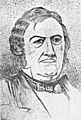
Thomas Morris, a U.S. Senator who fought against slavery.
-
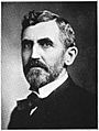
John M. Pattison, who became Governor of Ohio.
-
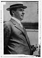
Hugh L. Nichols, a Lieutenant Governor and Chief Justice.


.jpg)
Clermont's last covered bridge was built in 1878 and was fixed up in 2014. Ulysses S. Grant's birthplace, which was a small cabin, is still a popular place to visit. It was even moved by boat and taken to the 1893 Chicago World's Fair before coming back to Clermont.
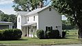
In 1905, John M. Pattison became the first person from Clermont County to be elected Governor of Ohio. He lived in Milford, and his home, called the Promont, was used as the official governor's residence. Today, this mansion is a museum. Hugh L. Nichols from Batavia also served as Lieutenant Governor and became the first Chief Justice of the Ohio Supreme Court in 1914. Orpha Gatch of Milford was the first woman elected to her local school board and helped start the League of Women Voters in the county.
Geography
Clermont County covers about 460 square miles. Most of this (452 square miles) is land, and a small part (7.7 square miles) is water.
Neighboring Counties
- Brown County (east)
- Bracken County, Kentucky (south)
- Pendleton County, Kentucky (southwest)
- Campbell County, Kentucky (southwest)
- Hamilton County (west)
- Warren County (north)
- Clinton County (northeast)
People in Clermont County (Demographics)
| Historical population | |||
|---|---|---|---|
| Census | Pop. | %± | |
| 1810 | 9,965 | — | |
| 1820 | 15,820 | 58.8% | |
| 1830 | 20,466 | 29.4% | |
| 1840 | 23,106 | 12.9% | |
| 1850 | 30,455 | 31.8% | |
| 1860 | 33,034 | 8.5% | |
| 1870 | 34,268 | 3.7% | |
| 1880 | 36,713 | 7.1% | |
| 1890 | 33,553 | −8.6% | |
| 1900 | 31,610 | −5.8% | |
| 1910 | 29,551 | −6.5% | |
| 1920 | 28,291 | −4.3% | |
| 1930 | 29,786 | 5.3% | |
| 1940 | 34,109 | 14.5% | |
| 1950 | 42,182 | 23.7% | |
| 1960 | 80,530 | 90.9% | |
| 1970 | 95,725 | 18.9% | |
| 1980 | 128,483 | 34.2% | |
| 1990 | 150,187 | 16.9% | |
| 2000 | 177,977 | 18.5% | |
| 2010 | 197,363 | 10.9% | |
| 2020 | 208,601 | 5.7% | |
| 2023 (est.) | 211,972 | 7.4% | |
| U.S. Decennial Census 1790–1960 1900–1990 1990–2000 2010-2020 |
|||
In 2010, there were 197,363 people living in Clermont County. Most people (95.9%) were white. About 1.2% were Black or African American, and 1.0% were Asian. People of Hispanic or Latino origin made up 1.5% of the population. Many people in Clermont County have German (34.0%), Irish (18.1%), American (12.0%), or English (11.1%) backgrounds.
The average age in the county was 38.5 years old. The average income for a family was about $68,485 per year.
Economy
Clermont County has its own airport, the Clermont County Airport. The local newspapers are the Clermont Sun and the Community Press papers. Here are some of the biggest employers in the county:
| # | Employer | # of Employees | Location |
|---|---|---|---|
| 1 | Total Quality Logistics | 2,000 | Union Township |
| 2 | American Modern Insurance Group | 1,207 | Batavia Township |
| 3 | Clermont County | 1,152 | Batavia |
| 4 | Mercy Hospital - Clermont Hospital | 850 | Batavia Township |
| 5 | West Clermont Local School District | 835 | Union Township |
| 6 | Milford Exempted Village School District | 767 | Miami Township |
| 7 | Siemens Digital Industries Software | 750 | Miami Township |
| 8 | Milacron | 662 | Williamsburg Township |
| 9 | L3 Harris Fuzing & Ordnance Systems | 607 | Withamsville |
| 10 | Huhtamaki, Inc. | 500 | Batavia Township |
Education
High Schools in Clermont County
Here are the high schools in Clermont County, along with the year their current buildings opened:
- (1957) Clermont Northeastern High School, Batavia
- (1963) Milford High School, Milford
- (1965) New Richmond High School, New Richmond
- (1996) Williamsburg High School, Williamsburg
- (1997) Batavia High School, Batavia
- (2002) Bethel-Tate High School, Bethel
- (2002) Goshen High School, Goshen
- (2004) Felicity-Franklin High School, Felicity
- (2017) West Clermont High School, Batavia
Colleges
- (1972) Clermont College, Batavia
Parks and Libraries
Clermont County has many natural places to enjoy. These include the Cincinnati Nature Center at Rowe Woods and Valley View Nature Preserve in Milford. The county also manages five parks, three nature preserves, and a hiking/biking trail, covering over 600 acres. You can also find East Fork State Park and Stonelick State Park here. The Clermont Public Libraries offer many books and resources for everyone.
Communities
Ohio has different types of communities: cities, villages, and townships.

Cities and villages have elected councils and a mayor. The mayor often leads local meetings and has other duties.
Cities
Villages
- Batavia (county seat)
- Bethel
- Chilo
- Felicity
- Moscow
- Neville
- New Richmond
- Owensville
- Williamsburg
Former Villages
Townships
- Batavia
- Franklin
- Goshen
- Jackson
- Miami
- Monroe
- Ohio
- Pierce
- Stonelick
- Tate
- Union
- Washington
- Wayne
- Williamsburg
Census-Designated Places
These are areas that are like towns but are not officially incorporated as cities or villages.
Other Unincorporated Communities
These are smaller places that are not officially part of a city or village.
- Afton
- Amelia
- Bantam
- Belfast
- Blairsville
- Blowville
- Branch Hill
- Braziers
- Cedron
- Clermontville
- Clover
- Concord
- Edenton
- Elk Lick
- Glen Este
- Grailville
- Hamlet
- Hennings Mill
- Hills
- Laurel
- Lerado
- Lindale
- Locust Corner
- Maple
- Marathon
- Milford Hills
- Modest
- Monterey
- Moores Fork
- Mount Holly
- Mount Olive
- Mount Pisgah
- New Palestine
- Ninemile
- Nineveh
- Nicholsville
- Olive Branch
- Perintown
- Point Isabel
- Point Pleasant
- Pringle Corner
- Round Bottom
- Rural
- Saltair
- Simpkinsville
- Shiloh
- Springvale
- Stonelick
- Tobasco
- Utopia
- Wards Corner
- Wiggonsville
- Williams Corner
- Willowville
- Woodville
Gallery
-
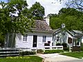
Amelia Bowdoin's House in Amelia
-
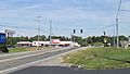
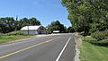
Goshen at Ohio Rt. 132
-
U.S. Grant's Birthplace at Point Pleasant
-
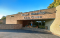
Miami Township Civic Center on Meijer Drive
-
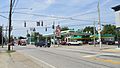
Main Owensville intersection at US Rt. 50 and Ohio Rt. 132
-
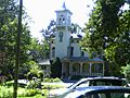
The Promont in Milford
-
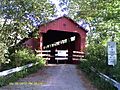
Stonelick-Williams Corner Covered Bridge near Owensville
-
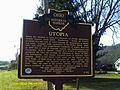
Utopia marker on US Rt. 52
-
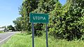
Utopia sign
-
Utopia, west on US Rt. 52
-
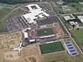
West Clermont High School aerial view


.JPG)


.JPG)
.JPG)


See also
 In Spanish: Condado de Clermont para niños
