
Miamiville, Ohio facts for kids
Quick facts for kids
Miamiville, Ohio
|
|
|---|---|

Looking west on Center Street in Miamiville
|
|

Location of Miamiville, Ohio
|
|
| Country | United States |
| State | Ohio |
| County | Clermont |
| Township | Miami |
| Elevation | 587 ft (179 m) |
| Population
(2020)
|
|
| • Total | 205 |
| Time zone | UTC-5 (Eastern (EST)) |
| • Summer (DST) | UTC-4 (EDT) |
| ZIP code |
45147
|
| Area code(s) | 513 |
| GNIS feature ID | 2628932 |
Miamiville is a small community in Ohio, United States. It is located in Clermont County, within Miami Township. Miamiville is found along the Little Miami River and the Loveland Bike Trail.
It is known as a census-designated place (CDP). This means it is a special area that the government counts for population statistics. In 2020, Miamiville had a population of 205 people. The community also has its own post office with the ZIP code 45147.
History of Miamiville
Miamiville was established in 1849. It got its name from the nearby Little Miami River. A post office for Miamiville started operating even earlier, in 1848.
Miamiville During the Civil War
Miamiville played a small part in the American Civil War. In the 1860s, a group of Confederate soldiers led by General John Hunt Morgan passed through the area. This event was part of what is known as Morgan's Raid. The soldiers were marching towards Camp Dennison and Cincinnati.
Gallery
-
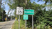
Miamiville community sign
-
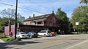
Miamiville Garage in Miamiville


See also
 In Spanish: Miamiville (Ohio) para niños
