Delta Mountains facts for kids
Quick facts for kids Delta Mountains |
|
|---|---|

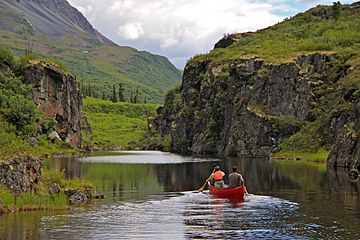
Delta River flowing through Delta Mountains
|
|
| Highest point | |
| Peak | Mount Kimball |
| Elevation | 10,300 ft (3,100 m) |
| Dimensions | |
| Length | 95 mi (153 km) |
| Geography | |
| Country | United States |
| State/Province | Alaska |
The Delta Mountains are a cool mountain range in Alaska, USA. They are part of the larger Alaska Range. These mountains are found in the eastern part of the Alaska Range.
The Delta Mountains stretch for about 95 miles (153 km) from east to west. They are located south of the Tanana River Valley. You can find them west of the Nabesna River and northwest of Wrangell–St. Elias National Park and Preserve. The mountains cover a large area of about 6,313 square miles (16,350 km²).
Tallest Peak: Mount Kimball
The highest point in the Delta Mountains is Mount Kimball. This impressive peak stands at 10,300 feet (3,139 meters) tall. It's a major landmark in the range.
The Delta River
The Delta River starts on the south side of the Delta Mountains. It begins near a place called Paxson. This river flows north right through the mountains. It runs between the Delta Mountains and the Hayes Range to the west.
The Delta River eventually joins the Tanana River. Since 1980, the Delta River has been special. It was named a National Wild and Scenic River. This means it's protected for its natural beauty and importance.
 | John T. Biggers |
 | Thomas Blackshear |
 | Mark Bradford |
 | Beverly Buchanan |


