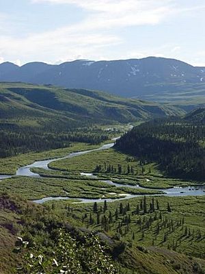
Delta River facts for kids
Quick facts for kids Delta River |
|
|---|---|

Delta River
|
|
|
Location of the mouth of the Delta River in Alaska
|
|
| Country | United States |
| State | Alaska |
| Census Area | Copper River, Southeast Fairbanks |
| Physical characteristics | |
| Main source | Tangle Lakes Amphitheater Mountains, Alaska Range, Copper River Census Area 2,823 ft (860 m) 63°09′14″N 145°56′54″W / 63.15389°N 145.94833°W |
| River mouth | Tanana River Big Delta, Southeast Fairbanks Census Area 984 ft (300 m) 64°09′19″N 145°51′35″W / 64.15528°N 145.85972°W |
| Length | 80 mi (130 km) |
| Type: | Wild, Scenic, Recreational |
| Designated: | December 2, 1980 |
The Delta River is a cool river in Alaska, United States. It's about 80 miles (129 km) long. This river flows into a bigger river called the Tanana River. In the Ahtna language, spoken by some Native Alaskans, its name is Saas Na’ .
The Delta River starts from the Tangle Lakes in the Alaska Range mountains. It then flows north until it meets the Tanana River near a place called Big Delta.
In 1980, a large part of the Delta River and the Tangle Lakes became special. About 62 miles (100 km) of these waterways are now part of the National Wild and Scenic Rivers System. This means they are protected for their natural beauty and importance. Some parts are called "wild," some "scenic," and others "recreational."
Boating Adventures on the Delta River
The Delta River is a popular spot for boating. You can easily get to the river from the Tangle Lakes campground near the Denali Highway. There are also many other places to start your trip along the Richardson Highway.
The river has different sections, each with its own level of difficulty. These are rated using the International Scale of River Difficulty.
- Class I (Easy): These parts are calm and easy to float.
- Class II (Medium): These sections have some small rapids that are a bit more exciting.
- Class III (Difficult): Here, the rapids are bigger and need more skill to navigate.
- Class IV (Very Difficult) or V (Extremely Difficult): These are the hardest parts, with very strong rapids and obstacles. Only experienced boaters should try these sections.
The river starts with four lakes and easy Class II channels connecting them. After the last lake, the river goes into a canyon. Here, there are waterfalls that are too dangerous to go over. Boaters must carry their boats around these waterfalls for about 0.5 miles (0.8 km). After this, there's a 2-mile (3.2 km) stretch of Class III rapids.
Further downstream, the river becomes calmer with 29 miles (47 km) of Class I and II water. But then, it enters a 20-mile (32 km) section called Black Rapids. This part is very challenging, with Class III, IV, or even V rapids. After Black Rapids, there are more Class III rapids for about 30 miles (48 km), followed by 18 miles (29 km) of easy Class I water.
It's important to be safe when boating on the Delta River. There can be dangers like fallen trees in the water, cold weather, and strong winds. Experts say that only very experienced boaters should try to go through the Black Rapids section.
Fishing in the Delta River System
The Tangle Lakes complex, which feeds the Delta River, is a great place for fishing. It's about 24 miles (39 km) long and is known for having some of the best Arctic grayling fishing in Interior Alaska. You can easily reach these spots by road.
In the deeper parts of the Tangle Lakes, you can find many lake trout. If you want to find places with fewer people fishing, you can go to lakes and streams that are away from the main highway. These spots can be reached by canoe or walking trails.
The upper part of the Delta River, down to where it meets Eureka Creek, is also considered excellent for catching Arctic grayling.
 | Mary Eliza Mahoney |
 | Susie King Taylor |
 | Ida Gray |
 | Eliza Ann Grier |


