Southeast Fairbanks Census Area, Alaska facts for kids
Quick facts for kids
Southeast Fairbanks Census Area
|
|
|---|---|

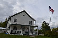
Historic Courthouse in Eagle, Alaska.
|
|

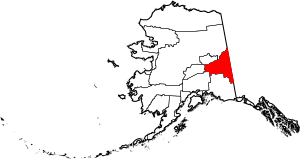
Location within the U.S. state of Alaska
|
|
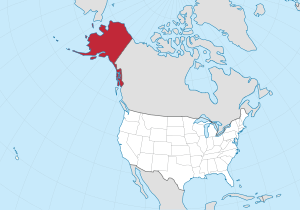
 Alaska's location within the U.S. |
|
| Country | |
| State | |
| Established | 1980 |
| Named for | its location to the southeast of Fairbanks, Alaska |
| Largest CDP | Deltana |
| Area | |
| • Total | 25,059 sq mi (64,900 km2) |
| • Land | 24,769 sq mi (64,150 km2) |
| • Water | 291 sq mi (750 km2) 1.2%% |
| Population
(2020)
|
|
| • Total | 7,021 |
| • Density | 0.28/sq mi (0.11/km2) |
| Time zone | UTC−9 (Alaska) |
| • Summer (DST) | UTC−8 (ADT) |
| Congressional district | At-large |
The Southeast Fairbanks Census Area is a special kind of area in Alaska, a state in the United States. It's called a census area because it helps the government count people. This area was created in 1980.
In 2020, about 6,808 people lived here. This area is part of what's called an "unorganized borough." This means it doesn't have a main city or town that acts as its government center, like other counties might. The biggest communities in this area are Deltana and Tok.
Contents
Geography of Southeast Fairbanks
The U.S. Census Bureau says this area is very large. It covers about 25,059 square miles (64,900 square kilometers). Most of this area is land, about 24,769 square miles (64,150 square kilometers). The rest, about 291 square miles (750 square kilometers), is water.
To give you an idea of its size, the Southeast Fairbanks Census Area is a little bit bigger than the entire state of West Virginia!
Neighboring Areas
The Southeast Fairbanks Census Area shares borders with several other areas:
- To the northwest: Fairbanks North Star Borough, Alaska
- To the north: Yukon-Koyukuk Census Area, Alaska
- To the south: Copper River Census Area, Alaska
- To the southwest: Matanuska-Susitna Borough, Alaska
- To the west: Denali Borough, Alaska
- To the east: Yukon Territory, which is part of Canada
Protected Natural Places
This area is home to parts of some important natural parks and refuges. These places help protect wildlife and nature.
- Tetlin National Wildlife Refuge (part of it is here)
- Wrangell-St. Elias National Park and Preserve (part of it is here)
- This includes part of the Wrangell-Saint Elias Wilderness
- Yukon-Charley Rivers National Preserve (part of it is here)
People and Population
Demographics is the study of people in an area, like their age, race, and how many there are.
| Historical population | |||
|---|---|---|---|
| Census | Pop. | %± | |
| 1970 | 4,179 | — | |
| 1980 | 5,676 | 35.8% | |
| 1990 | 5,913 | 4.2% | |
| 2000 | 6,174 | 4.4% | |
| 2010 | 7,029 | 13.8% | |
| 2020 | 6,808 | −3.1% | |
| 2023 (est.) | 7,077 | 0.7% | |
| U.S. Decennial Census 1900–1990 1990–2000 2010–2020 |
|||
In the year 2000, there were 6,174 people living in the Southeast Fairbanks Census Area. There were 2,098 households, which are like homes where people live. About 1,506 of these were families.
The population was spread out by age:
- 32.8% were under 18 years old.
- 7.6% were between 18 and 24 years old.
- 27.8% were between 25 and 44 years old.
- 25.7% were between 45 and 64 years old.
- 6.1% were 65 years old or older.
The average age of people living there was 34 years. For every 100 females, there were about 107 males.
2020 Census Information
The 2020 United States Census collected information about the different groups of people living in the Southeast Fairbanks Census Area.
| Race | Percentage of Population |
|---|---|
| White | 82.70% |
| Black or African American | 1.87% |
| American Indian or Alaska Native | 16.64% |
| Asian | 2.75% |
| Native Hawaiian and Other Pacific Islander | 1.10% |
| Some other race | 4.48% |
Towns and Villages
The Southeast Fairbanks Census Area has several communities. Some are officially called cities, and others are called census-designated places (CDPs). CDPs are areas that are like towns but are not officially incorporated as cities.
Cities
Census-designated places
- Alcan Border
- Big Delta
- Chicken
- Deltana
- Dot Lake
- Dot Lake Village
- Dry Creek
- Eagle Village
- Fort Greely
- Healy Lake
- Northway
- Northway Junction (used to be a CDP)
- Northway Village (used to be a CDP)
- Tanacross
- Tetlin
- Tok
- Whitestone
See also
 In Spanish: Área censal de Southeast Fairbanks para niños
 | Kyle Baker |
 | Joseph Yoakum |
 | Laura Wheeler Waring |
 | Henry Ossawa Tanner |

