Fort Greely, Alaska facts for kids
Quick facts for kids
Fort Greely, Alaska
|
|
|---|---|

Fort Greely
|
|
| Country | United States |
| State | Alaska |
| Census Area | Southeast Fairbanks |
| Area | |
| • Total | 11.03 sq mi (28.56 km2) |
| • Land | 11.03 sq mi (28.56 km2) |
| • Water | 0.00 sq mi (0.00 km2) |
| Population
(2022)
|
|
| • Total | 458 |
| • Density | 28.02/sq mi (10.82/km2) |
| Time zone | UTC-9 (Alaska (AKST)) |
| • Summer (DST) | UTC-8 (AKDT) |
| ZIP code |
99731
|
| Area code(s) | 907 |
| FIPS code | 02-26100 |

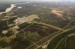
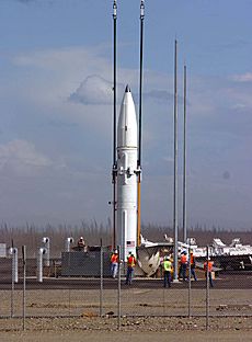
Fort Greely is a small community in Alaska, United States. It is located in the Southeast Fairbanks Census Area. This area is well-known for being home to the Fort Greely military base. In 2022, about 458 people lived in Fort Greely.
Contents
Geography of Fort Greely
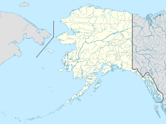
Fort Greely is located in a specific spot in Alaska, at coordinates 63°58′2″N 145°42′33″W. It is about 5 miles (8 km) south of a town called Delta Junction. You can find it right along the Richardson Highway.
The community covers a total area of about 169.7 square miles (439.5 km²). Most of this area, about 169.4 square miles (438.7 km²), is land. A small part, about 0.4 square miles (1.0 km²), is water.
Fort Greely's Nuclear Power History
Because Fort Greely is in a very remote area, it was chosen for an interesting project. It became one of the first U.S. military bases to have a small nuclear power plant. This plant was built to create heat and electricity for the base.
The nuclear power plant, called SM-1A, was brought in and set up between 1960 and 1962. It was based on an earlier reactor model. The SM-1A reactor started working on March 13, 1962. It was later shut down in 1972, and its core was safely removed.
Population and People of Fort Greely
| Historical population | |||
|---|---|---|---|
| Census | Pop. | %± | |
| 1970 | 1,820 | — | |
| 1980 | 1,635 | −10.2% | |
| 1990 | 1,147 | −29.8% | |
| 2000 | 461 | −59.8% | |
| 2010 | 539 | 16.9% | |
| 2020 | 309 | −42.7% | |
| U.S. Decennial Census | |||
Fort Greely first appeared on the U.S. Census in 1970 as a military base. In 1980, it was officially named a "census-designated place" (CDP). This means it's an area identified by the census for statistical purposes.
According to the 2000 census, 461 people lived in Fort Greely. There were 126 households, and most of them were families. Many households had children under 18 living with them. The average household had about 3.25 people.
The population of Fort Greely is quite young. In 2000, about 38.6% of the people were under 18 years old. The average age was 23 years. This shows that many young people and families live on the military base.
Climate in Fort Greely
Fort Greely is not close to the ocean, so its weather is different from coastal Alaska. It has very dry conditions and experiences extreme temperatures, which are common in subarctic areas.
The area gets only about 12 inches (305 mm) of rain each year. This includes about 37 inches (94 cm) of snow. In January, the average low temperature is around -11 °F (-23 °C). In July, the average high temperature is about +69 °F (+20 °C). The coldest temperature ever recorded was -63 °F (-53 °C), and the hottest was +92 °F (+33 °C).
During the summer, from May to July, Fort Greely is mostly sunny. There is no real night, only a dim twilight. In the winter, from November to January, there is very little daylight. On clear winter nights, you can often see the amazing aurora borealis, also known as the Northern Lights, dancing in the sky.
See also
 In Spanish: Fort Greely (Alaska) para niños
 | Isaac Myers |
 | D. Hamilton Jackson |
 | A. Philip Randolph |


