Tok, Alaska facts for kids
Quick facts for kids
Tok, Alaska
|
|
|---|---|
 |
|

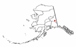
Location of Tok, Alaska
|
|
| Country | United States |
| State | Alaska |
| Census Area | Southeast Fairbanks |
| Area | |
| • Total | 133.52 sq mi (345.82 km2) |
| • Land | 133.52 sq mi (345.82 km2) |
| • Water | 0.00 sq mi (0.00 km2) |
| Elevation | 1,620 ft (490 m) |
| Population
(2020)
|
|
| • Total | 1,243 |
| • Density | 9.31/sq mi (3.59/km2) |
| Time zone | UTC-9 (Alaska (AKST)) |
| • Summer (DST) | UTC-8 (AKDT) |
| ZIP code |
99780
|
| Area code(s) | 907 |
| FIPS code | 02-77800 |
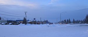
Tok is a small community in Alaska, United States. It is known as a "census-designated place" (CDP). This means it's a special area counted by the government for population, but it's not officially a city or town. In 2020, about 1,243 people lived there.
Contents
Where is Tok Located?
Tok is in the Southeast Fairbanks Census Area, Alaska. It sits on a large, flat area of land called the Tanana Valley. This valley is between the Tanana River and the big Alaska Range mountains.
Tok is an important spot because two major roads meet there: the Alaska Highway and the Glenn Highway. The area of Tok covers about 132 square miles (345 square kilometers), and all of it is land.
What's the Weather Like in Tok?
Tok has a very specific type of climate. It has dry winters and very cold temperatures. Summers are generally warm. The weather station in Tok is about 1,620 feet (494 meters) above sea level.
| Climate data for Tok, Alaska, 1991–2020 normals, extremes 1954–2017 | |||||||||||||
|---|---|---|---|---|---|---|---|---|---|---|---|---|---|
| Month | Jan | Feb | Mar | Apr | May | Jun | Jul | Aug | Sep | Oct | Nov | Dec | Year |
| Record high °F (°C) | 43 (6) |
43 (6) |
69 (21) |
74 (23) |
88 (31) |
96 (36) |
95 (35) |
93 (34) |
83 (28) |
67 (19) |
49 (9) |
40 (4) |
96 (36) |
| Mean maximum °F (°C) | 19.3 (−7.1) |
29.1 (−1.6) |
43.2 (6.2) |
61.2 (16.2) |
74.1 (23.4) |
83.9 (28.8) |
85.7 (29.8) |
81.2 (27.3) |
68.1 (20.1) |
49.8 (9.9) |
25.5 (−3.6) |
19.3 (−7.1) |
87.4 (30.8) |
| Mean daily maximum °F (°C) | −3.7 (−19.8) |
8.3 (−13.2) |
24.1 (−4.4) |
44.6 (7.0) |
61.0 (16.1) |
71.1 (21.7) |
72.2 (22.3) |
66.8 (19.3) |
53.6 (12.0) |
31.4 (−0.3) |
8.0 (−13.3) |
−2.4 (−19.1) |
36.3 (2.4) |
| Daily mean °F (°C) | −11.9 (−24.4) |
−2.5 (−19.2) |
9.6 (−12.4) |
31.2 (−0.4) |
45.9 (7.7) |
56.5 (13.6) |
59.1 (15.1) |
53.5 (11.9) |
42.1 (5.6) |
22.7 (−5.2) |
0.0 (−17.8) |
−10.1 (−23.4) |
24.7 (−4.1) |
| Mean daily minimum °F (°C) | −20.0 (−28.9) |
−13.2 (−25.1) |
−4.9 (−20.5) |
17.7 (−7.9) |
30.8 (−0.7) |
41.9 (5.5) |
46.0 (7.8) |
40.2 (4.6) |
30.6 (−0.8) |
14.0 (−10.0) |
−7.9 (−22.2) |
−17.7 (−27.6) |
13.1 (−10.5) |
| Mean minimum °F (°C) | −48.6 (−44.8) |
−41.3 (−40.7) |
−30.2 (−34.6) |
−7.0 (−21.7) |
19.4 (−7.0) |
28.3 (−2.1) |
34.1 (1.2) |
25.4 (−3.7) |
15.6 (−9.1) |
−11.4 (−24.1) |
−33.3 (−36.3) |
−42.3 (−41.3) |
−54.5 (−48.1) |
| Record low °F (°C) | −71 (−57) |
−67 (−55) |
−57 (−49) |
−33 (−36) |
3 (−16) |
16 (−9) |
10 (−12) |
13 (−11) |
−13 (−25) |
−41 (−41) |
−59 (−51) |
−70 (−57) |
−71 (−57) |
| Average precipitation inches (mm) | 0.43 (11) |
0.21 (5.3) |
0.20 (5.1) |
0.21 (5.3) |
0.87 (22) |
2.37 (60) |
2.29 (58) |
1.32 (34) |
0.95 (24) |
0.55 (14) |
0.62 (16) |
0.58 (15) |
10.60 (269) |
| Average snowfall inches (cm) | 4.9 (12) |
3.5 (8.9) |
3.3 (8.4) |
2.4 (6.1) |
0.9 (2.3) |
0.0 (0.0) |
0.0 (0.0) |
0.0 (0.0) |
1.8 (4.6) |
4.9 (12) |
8.2 (21) |
7.7 (20) |
37.6 (95.3) |
| Average precipitation days (≥ 0.01 in) | 2.7 | 2.2 | 2.3 | 1.8 | 4.9 | 9.5 | 10.6 | 8.5 | 6.4 | 4.8 | 4.5 | 4.8 | 63.0 |
| Average snowy days (≥ 0.1 in) | 2.8 | 2.5 | 2.0 | 1.4 | 0.4 | 0.0 | 0.0 | 0.0 | 0.9 | 3.9 | 4.4 | 4.9 | 23.2 |
| Source: NOAA | |||||||||||||
How Many People Live in Tok?
| Historical population | |||
|---|---|---|---|
| Census | Pop. | %± | |
| 1950 | 104 | — | |
| 1960 | 129 | 24.0% | |
| 1970 | 214 | 65.9% | |
| 1980 | 589 | 175.2% | |
| 1990 | 935 | 58.7% | |
| 2000 | 1,393 | 49.0% | |
| 2010 | 1,258 | −9.7% | |
| 2020 | 1,243 | −1.2% | |
| U.S. Decennial Census | |||
Tok first appeared on the U.S. Census in 1950. It was called "Tok Junction" back then. By 1960, the name was shortened to just Tok. In 1980, it became a "census-designated place" (CDP).
Tok's History
People from the Athabascan group have lived in the Tok area for many hundreds of years.
The modern town of Tok started in 1942. It was a camp for the Alaska Road Commission. This group was building and taking care of the Alaska Highway. So much money was spent on this camp that people called it "Million Dollar Camp."
The first school in Tok opened in 1947. A bigger school was built in 1958 for all the new people moving in. In 1995, an even newer school was opened.
Between 1954 and 1979, a fuel pipeline ran through Tok. It carried fuel from Haines to Fairbanks. Tok had a pump station for this pipeline.
The "Miracle Wind" Fire
In July 1990, Tok was in great danger. A huge forest fire, started by lightning, jumped over two rivers and the Alaska Highway. This put homes and people at risk. Everyone in Tok had to leave. More than a thousand firefighters tried to stop the fire. But at the last moment, a "miracle wind" (as locals called it) changed direction. This wind pushed the fire away from the first buildings in town. The fire kept burning for the rest of the summer. It burned over 100,000 acres (400 square kilometers) of land.
On January 10, 2009, Tok was in the news for a very cold temperature. It was reported to be -80 degrees Fahrenheit (-62 degrees Celsius)!
What Does the Name "Tok" Mean?
There are a few ideas about where the name Tok comes from:
- One idea is that "Tok" comes from an Athabascan word meaning "peaceful crossing."
- Another idea is that it came from "Tokyo camp." This was a name used during World War II.
- Some say it was named after a dog mascot from one of the engineer groups that built the highways.
- The name "Tok" is not connected to the community of Newtok in western Alaska.
Another story about the name comes from road building. In the 1940s and 1950s, a road called the Tok Cut-Off was built. It connected Tok to the Richardson Highway at Glennallen. This road was a "cut-off" because it let travelers from the southern United States get to Valdez and Anchorage without going too far north. When the road was being planned from the air, the map showed a "T" intersection. The letters "OK" were added to show that the spot was good for building.
Schools in Tok
Tok is part of the Alaska Gateway School District. The main school is Tok School. It teaches students from kindergarten all the way to 12th grade. About 200 students attend this school.
There is also a small office for the University of Alaska. It offers classes both online and sometimes in person for the community.
Tok's Economy
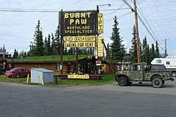
The most common jobs in Tok are in building, healthcare, and places where tourists stay. About 8% of people in Tok are looking for work. A big part of Tok's economy comes from tourism. Many visitors stop in Tok while traveling through Alaska.
Fun Places to Visit Near Tok
There are several state parks close to Tok where people can enjoy nature.
- The Tok River State Recreation Site is a small park, about 9 acres (3.6 hectares) in size. It's about 4.5 miles (7.2 kilometers) east of Tok. It has a small campground, trails, and a place to launch small boats into the river. The land across the river from the park is still recovering from the big 1990 wildfire.
- The Eagle Trail State Recreation Site is a larger park, about 280 acres (113 hectares). It's about 19 miles (31 kilometers) south of Tok, on the Tok Cutoff road. This park has a campground, picnic areas, and hiking trails. You can also reach the old Valdez-Eagle Trail and the high mountains of the Alaska Range from here.
- The Moon Lake State Recreation Site is a small park, about 22 acres (8.9 hectares). It's off the Alaska Highway, about 15 miles (24 kilometers) northwest of Tok. It has a small campground, a beach, and a place to launch small boats. It's also a popular spot for floatplanes to land.
See also
 In Spanish: Tok (Alaska) para niños
 | Delilah Pierce |
 | Gordon Parks |
 | Augusta Savage |
 | Charles Ethan Porter |


