Glennallen, Alaska facts for kids
Quick facts for kids
Glennallen
Ciisik’e Na’
|
|
|---|---|

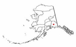
Location of Glennallen, Alaska
|
|
| Country | United States |
| State | Alaska |
| Census Area | Copper River |
| Area | |
| • Total | 115.60 sq mi (299.41 km2) |
| • Land | 115.07 sq mi (298.04 km2) |
| • Water | 0.53 sq mi (1.37 km2) |
| Elevation | 1,434 ft (437 m) |
| Population
(2020)
|
|
| • Total | 439 |
| • Density | 3.81/sq mi (1.47/km2) |
| Time zone | UTC-9 (Alaska (AKST)) |
| • Summer (DST) | UTC-8 (AKDT) |
| ZIP code |
99588
|
| Area code(s) | 907 |
| FIPS code | 02-28740 |
| GNIS feature ID | 1402643 |
Glennallen (pronounced glenn-AL-en), or Ciisik’e Na’ in the Ahtna language, is a small community in Alaska, USA. It is known as a census-designated place (CDP). This means it's a place that the government counts for population, but it doesn't have its own city government.
Glennallen is located in the Copper River Census Area. In 2020, about 439 people lived there. It is the biggest community in its census area.
Contents
Geography and Climate
Where is Glennallen?
Glennallen is in south-central Alaska. It sits at about 62 degrees North latitude and 145 degrees West longitude. This location is in the Chitina Recording District.
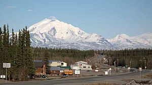
The community is found where two major roads meet. These are the Glenn Highway and the Richardson Highway. It's about 189 miles (304 km) east of Anchorage. Glennallen is also very close to the western edge of Wrangell-St. Elias National Park and Preserve. This is a huge national park.
The area of Glennallen is about 115 square miles (299 square kilometers). Most of this area is land. Only a small part, about 0.8 square miles (1.37 square kilometers), is water.
What is the Climate Like?
Glennallen has a subarctic climate with dry summers. This means it has very long and cold winters. The summers are usually warm.
| Climate data for Glennallen, Alaska (1991–2020 normals, extremes 1965–present) | |||||||||||||
|---|---|---|---|---|---|---|---|---|---|---|---|---|---|
| Month | Jan | Feb | Mar | Apr | May | Jun | Jul | Aug | Sep | Oct | Nov | Dec | Year |
| Record high °F | 47 | 47 | 56 | 71 | 81 | 92 | 96 | 89 | 76 | 72 | 46 | 45 | 96 |
| Mean maximum °F | 34.2 | 38.2 | 44.9 | 56.8 | 73.0 | 81.9 | 83.7 | 77.8 | 67.2 | 53.3 | 36.7 | 33.9 | 86.3 |
| Mean daily maximum °F | 4.1 | 15.0 | 28.1 | 44.7 | 58.3 | 67.2 | 69.9 | 64.7 | 54.8 | 36.5 | 14.1 | 5.6 | 38.6 |
| Daily mean °F | −5.2 | 3.2 | 13.0 | 32.0 | 44.7 | 54.1 | 57.7 | 53.2 | 43.4 | 26.1 | 5.1 | −2.5 | 27.1 |
| Mean daily minimum °F | −14.4 | −8.7 | −2.0 | 19.3 | 31.1 | 41.0 | 45.5 | 41.6 | 32.0 | 15.7 | −3.9 | −10.6 | 15.6 |
| Mean minimum °F | −41.6 | −34.4 | −25.7 | −0.7 | 20.7 | 28.5 | 33.9 | 26.8 | 16.4 | −6.2 | −30.3 | −34.1 | −46.4 |
| Record low °F | −61 | −60 | −50 | −30 | 10 | 23 | 25 | 16 | −5 | −30 | −55 | −56 | −61 |
| Average precipitation inches | 0.70 | 0.80 | 0.44 | 0.18 | 0.71 | 1.48 | 1.74 | 1.83 | 1.41 | 0.85 | 1.19 | 0.79 | 12.12 |
| Average snowfall inches | 10.5 | 7.4 | 4.9 | 2.5 | 0.8 | 0.0 | 0.0 | 0.0 | 0.4 | 7.5 | 11.1 | 11.5 | 56.6 |
| Record high °C | 8 | 8 | 13 | 22 | 27 | 33 | 36 | 32 | 24 | 22 | 8 | 7 | 36 |
| Mean daily maximum °C | −15.5 | −9.4 | −2.2 | 7.1 | 14.6 | 19.6 | 21.1 | 18.2 | 12.7 | 2.5 | −9.9 | −14.7 | 3.7 |
| Daily mean °C | −20.7 | −16.0 | −10.6 | 0.0 | 7.1 | 12.3 | 14.3 | 11.8 | 6.3 | −3.3 | −14.9 | −19.2 | −2.7 |
| Mean daily minimum °C | −25.8 | −22.6 | −18.9 | −7.1 | −0.5 | 5.0 | 7.5 | 5.3 | 0.0 | −9.1 | −19.9 | −23.7 | −9.1 |
| Record low °C | −52 | −51 | −46 | −34 | −12 | −5 | −4 | −9 | −21 | −34 | −48 | −49 | −52 |
| Average precipitation mm | 18 | 20 | 11 | 4.6 | 18 | 38 | 44 | 46 | 36 | 22 | 30 | 20 | 307.6 |
| Average snowfall cm | 27 | 19 | 12 | 6.4 | 2.0 | 0.0 | 0.0 | 0.0 | 1.0 | 19 | 28 | 29 | 143.4 |
| Average precipitation days (≥ 0.01 in) | 6.6 | 4.9 | 2.9 | 1.6 | 4.2 | 8.5 | 10.6 | 11.1 | 9.2 | 6.2 | 5.6 | 6.3 | 77.7 |
| Average snowy days (≥ 0.1 in) | 7.3 | 5.2 | 3.2 | 1.4 | 0.7 | 0.0 | 0.0 | 0.0 | 0.3 | 4.7 | 6.8 | 8.1 | 37.7 |
| Source: NOAA | |||||||||||||
History and Culture
Long ago, the Ahtna people lived in the Copper River Valley. They hunted and fished for food. Fish and game were usually easy to find there. Today, Ahtna people still live in communities around Glennallen.
In 1899, the U.S. Army built a summer trail. This trail went from the port of Valdez to Eagle. It passed right through the Copper River Valley. Later, in the early 1900s, this trail became the Richardson Highway.
Glennallen's Role in World War II
During World War II, the United States built many military bases in Alaska. These bases helped send planes and supplies to Russia. This was part of a program called Lend-lease. It made it harder for Germany and Japan to stop the supplies.
To support these bases, new highways were built. The Alaska Highway connected British Columbia, Canada, to the Richardson Highway. This linked to Fairbanks. Another important road was the Glenn Highway. It connected Anchorage, Alaska's largest city, to the Richardson Highway. This linked Anchorage to the rest of Alaska, Canada, and the other 48 U.S. states.
How Glennallen Got Its Name
Construction for the Glenn Highway started at a camp. This camp was on the Richardson Highway in the Copper River Valley. It was named Glennallen. The name came from two U.S. Army explorers from the late 1800s: Captain Edwin Forbes Glenn and Lieutenant Henry T. Allen.
The Glenn Highway was finished in 1945. Glennallen grew into a small town around this camp. It became a busy place for cars and trucks traveling on the Glenn and Richardson highways. It is one of the few towns in the area that wasn't built on an old Native village site.
Growth and Changes
In the 1950s and 1960s, another highway was built. This was the Tok Cut-Off. It connected a point north of Glennallen to Tok. This made Glennallen even more important for trade.
Also, in 1956, a school called Copper Valley School opened. This school brought more people to the area. In 1961, the U.S. Postal Service officially changed the spelling from "Glenallen" to "Glennallen."
Glennallen's economy grew more when the Trans-Alaska Pipeline System was built from 1975 to 1977. The town helped provide services for the pipeline. However, a new road, the George Parks Highway, later connected Anchorage to Denali National Park and Fairbanks. This new road bypassed Glennallen, which affected its economy.
Population of Glennallen
| Historical population | |||
|---|---|---|---|
| Census | Pop. | %± | |
| 1950 | 142 | — | |
| 1960 | 169 | 19.0% | |
| 1970 | 363 | 114.8% | |
| 1980 | 511 | 40.8% | |
| 1990 | 451 | −11.7% | |
| 2000 | 554 | 22.8% | |
| 2010 | 483 | −12.8% | |
| 2020 | 439 | −9.1% | |
| U.S. Decennial Census | |||
Glennallen first appeared in the U.S. Census in 1950. At that time, 142 people lived there. It became a census-designated place (CDP) in 1980.
In the year 2000, there were 554 people living in Glennallen. About 37% of the homes had children under 18. Most homes were married couples living together. The average age of people in Glennallen was 32 years old.
Economy and Transportation
What is the Economy Like?
Glennallen is a main supply center for the Copper River region. Local businesses serve the people who live there. They also help tourists traveling on the Glenn Highway. The town provides supplies, services, schools, and medical care.
State highway maintenance offices and federal offices are in Glennallen. There are also RV parks, places to stay, and gas stations for travelers. The National Park Service has a visitor center nearby. The Bureau of Land Management and Alaska State Troopers also have offices here. Some small farms are in the area. Glennallen is also home to Ahtna, Incorporated, a Native corporation.
How Do People Get Around?
The Glenn/Tok Cutoff and Richardson Highways allow people to drive to other parts of Alaska all year. There are also two airports nearby. Brenwick's Airport is a public airport with scheduled flights. The Gulkana Airport is about 4.3 miles northeast of town.
Parks and Recreation
There are fun outdoor places near Glennallen. The road to Lake Louise State Recreation Area is west of town on the Glenn Highway. This area is about 17 miles away.
North of Glennallen on the Richardson Highway is the Dry Creek State Recreation Site. This park is 360 acres big. It has a large campground, trails for walking, and places to fish for trout. Be aware that the access road can be bumpy, and there might be many mosquitoes.
See also
 In Spanish: Glennallen (Alaska) para niños
 | Shirley Ann Jackson |
 | Garett Morgan |
 | J. Ernest Wilkins Jr. |
 | Elijah McCoy |


