Dentonia, Kansas facts for kids
Quick facts for kids
Dentonia, Kansas
|
|
|---|---|

|
|
| Country | United States |
| State | Kansas |
| County | Jewell |
| Elevation | 1,736 ft (529 m) |
| Population | |
| • Total | 0 |
| Time zone | UTC-6 (CST) |
| • Summer (DST) | UTC-5 (CDT) |
| Area code | 785 |
| FIPS code | 20-17760 |
| GNIS ID | 484589 |
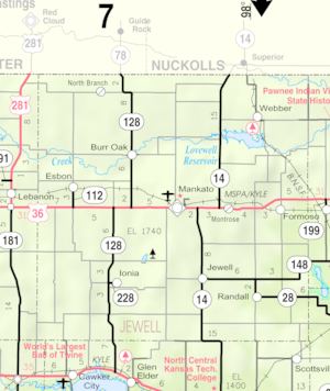
Dentonia is a ghost town located in Jewell County, Kansas, United States. A ghost town is a place where most or all people have left, leaving behind empty buildings and a quiet past.
Contents
The Story of Dentonia: A Kansas Ghost Town
Dentonia was once a small, busy farming village in Kansas. It started to grow in 1882.
Early Days and Growth
When Dentonia was first settled, it quickly got its own post office. This was a big deal because it helped people send and receive mail. The village grew steadily, and by 1910, about 60 people lived there.
At its busiest, Dentonia had many important buildings for its residents. These included:
- a blacksmith's shop, where metal items were made and repaired
- a doctor's office, for health care
- a dance hall, for fun and gatherings
- a general store, where people bought supplies
- a church, for worship
- a school, for children's education
The post office, which helped the town start, closed down in 1903.
Population Changes Over Time
After its peak, Dentonia's population began to shrink.
- By 1920, only 34 people lived in the village.
- By 1940, the number dropped even more, to just 3 residents.
Community Life and Decline
Dentonia had a school district, known as District 109. The local store was also a meeting place for community groups. These included the Independent Order of Odd Fellows and the Rebekah Lodge. These groups were like clubs that helped people in the community.
The general store, a central part of the town, closed around 1959 and was later torn down. This was a sign that the town was losing its businesses.
The last people living in Dentonia moved away after the school closed in 1964. Even after everyone left, the church continued to hold services for many years. It stayed open until 1998. Sadly, the church building was destroyed by a fire in 2002. Today, Dentonia is a true ghost town, with only memories of its past.
 | Jessica Watkins |
 | Robert Henry Lawrence Jr. |
 | Mae Jemison |
 | Sian Proctor |
 | Guion Bluford |


