Dewart, Pennsylvania facts for kids
Quick facts for kids
Dewart, Pennsylvania
|
|
|---|---|

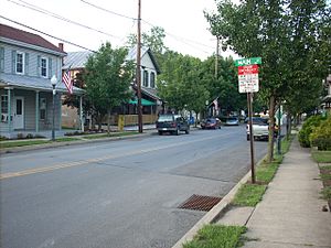
Street in Dewart
|
|
| Country | United States |
| State | Pennsylvania |
| County | Northumberland |
| Area | |
| • Total | 2.04 sq mi (5.28 km2) |
| • Land | 2.04 sq mi (5.28 km2) |
| • Water | 0.00 sq mi (0.00 km2) |
| Population
(2020)
|
|
| • Total | 1,385 |
| • Density | 679.92/sq mi (262.46/km2) |
| Time zone | UTC-5 (Eastern (EST)) |
| • Summer (DST) | UTC-4 (EDT) |
| ZIP code |
17777
|
| Area code(s) | 272 and 570 |
| FIPS code | 42-19048 |
Dewart is a small community in Pennsylvania, USA. It is known as a census-designated place. This means it is an area that the government counts for population information. Dewart is located in Delaware Township. This township is part of Northumberland County.
The community is very close to the West Branch Susquehanna River. You can find Dewart along Pennsylvania Route 405. This road runs through the northern part of Northumberland County.
Contents
About Dewart, Pennsylvania
Dewart is a quiet place with a friendly feel. It is surrounded by the natural beauty of Pennsylvania. The nearby Susquehanna River offers chances for outdoor fun.
Where is Dewart Located?
Dewart is in the state of Pennsylvania. It is in the central part of the state. The community sits right next to the West Branch Susquehanna River. This river is a major waterway in Pennsylvania.
How Big is Dewart?
Dewart covers a total area of about 5.28 square kilometers. This is roughly 2.04 square miles. All of this area is land. There are no large bodies of water within its borders.
People of Dewart
The number of people living in Dewart changes over time. The government counts the population every ten years. This is called the U.S. Decennial Census.
Population Numbers
In the year 2010, the population of Dewart was 1,471 residents. By the 2020 census, the population was 1,385 people.
| Historical population | |||
|---|---|---|---|
| Census | Pop. | %± | |
| 2020 | 1,385 | — | |
| U.S. Decennial Census | |||
See also
 In Spanish: Dewart para niños
 | Aaron Henry |
 | T. R. M. Howard |
 | Jesse Jackson |

