Diamond, Indiana facts for kids
Quick facts for kids
Diamond, Indiana
|
|
|---|---|

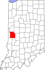
Parke County's location in Indiana
|
|
| Country | United States |
| State | Indiana |
| County | Parke |
| Township | Raccoon |
| Elevation | 636 ft (194 m) |
| Time zone | UTC-5 (Eastern (EST)) |
| • Summer (DST) | UTC-4 (EDT) |
| ZIP code |
47874
|
| Area code(s) | 765 |
| GNIS feature ID | 433527 |
Diamond, also known as Caseyville, is a small, unincorporated community located in Parke County, Indiana, in the United States. An unincorporated community means it's a recognized place that doesn't have its own local government, like a city or town. Instead, it's part of a larger county or township.
Contents
Discovering Diamond: A Look at its Past
Diamond was officially planned and marked out on a map in 1893. It was created as a "coal town," which means it was built mainly for people who worked in the nearby coal mines. These towns were important for supporting the mining industry.
Why is it Called Diamond?
The community got its name because of the special coal found there. The name "Diamond" was chosen to reflect the valuable, diamond-shaped pieces of coal that were mined in the area. This shows how important coal was to the community's beginning.
Where is Diamond Located?
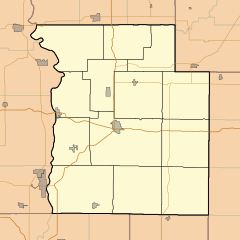
Diamond is found in the southern part of Raccoon Township, within Parke County. It is in the state of Indiana, which is in the Midwestern United States.
What are its Coordinates?
You can find Diamond on a map using its geographic coordinates: 39 degrees, 36 minutes, 41 seconds North latitude and 87 degrees, 9 minutes, 58 seconds West longitude. This helps pinpoint its exact location on Earth.
How High is Diamond?
Diamond sits at an elevation of about 636 feet (or 194 meters) above sea level. This measurement tells us how high the land is compared to the ocean.
 | Madam C. J. Walker |
 | Janet Emerson Bashen |
 | Annie Turnbo Malone |
 | Maggie L. Walker |


