Dick Brook facts for kids
Quick facts for kids Dick Brook |
|
|---|---|

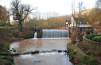
Priors Mill
|
|
|
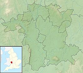
Location within Worcestershire
|
|
| Country | England |
| Counties | Worcestershire |
| Physical characteristics | |
| River mouth | River Severn, Worcestershire 52°17′53″N 2°16′34″W / 52.298°N 2.276°W |
| Length | 7.5 km (4.7 mi) |
| Basin features | |
| Basin size | 38 km2 (15 sq mi) |
The Dick Brook is a small, interesting stream in Worcestershire, England. It's like a little helper river, joining up with the much bigger River Severn. This brook is an important part of the local landscape.
Contents
The Journey of Dick Brook
Where Does Dick Brook Start?
The Dick Brook doesn't start as one big stream. Instead, it begins when two smaller, unnamed streams meet up. This meeting point is called Joan's Hole, located west of a place called Dunley. The longest of these starting streams collects water from around Rock, with its very beginning near Clows Top.
Flowing Through the Countryside
From Joan's Hole, the Dick Brook flows mostly towards the south-east. It travels for about 7.5 kilometers (which is about 4.7 miles). Along its path, it passes by several interesting spots.
Priors Mill and Old Bridges
When the brook reaches the edge of Astley village, it was once held back by a dam. This dam helped power Priors Mill, an old mill that used the water's energy. Just south of Astley, at a place called New Bridge, you can see a special old bridge. It's a packhorse bridge, which means it was built long ago for horses carrying goods. This bridge is located below the old monastery at Glasshampton.
Towards the River Severn
Further along its journey, north of Noutard's Green, the brook flows under Glazen Bridge (which is part of the B4196 road). It then continues along the northern edge of Shrawley wood. Finally, the Dick Brook reaches its destination and joins the mighty River Severn.
The Brook's Watery Area
The area of land that collects rainwater and sends it into the Dick Brook is called its drainage basin. This basin covers about 38 square kilometers (or 15 square miles). It sits between the drainage area of the Gladder Brook to the north and the Shrawley Brook to the south.
A Short Canal Section
Around the year 1717, a very small part of the Dick Brook was changed into a canal. This was done so that small boats could travel upstream from the River Severn to Astley Forge. To help the boats move through different water levels, two special gates called flash locks were built. You can even see the date "1717" on one of these old lock chambers!
 | James B. Knighten |
 | Azellia White |
 | Willa Brown |


