Dolington, Pennsylvania facts for kids
Quick facts for kids
Dolington, Pennsylvania
|
|
|---|---|
|
Unincorporated community
|
|

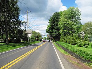
Southbound PA 532 approaching Lindenhurst Road
|
|
| Country | United States |
| State | Pennsylvania |
| County | Bucks |
| Township | Upper Makefield |
| Elevation | 259 ft (79 m) |
| Time zone | UTC-5 (Eastern (EST)) |
| • Summer (DST) | UTC-4 (EDT) |
| ZIP Code |
18940
|
| Area code(s) | 215, 267 and 445 |
| GNIS feature ID | 1203431 |
Dolington is a small, quiet place in Bucks County, Pennsylvania, United States. It's known as an unincorporated community. This means it's a group of homes and businesses that don't have their own local government like a city or town. Instead, it's part of a larger area called Upper Makefield Township.
What is an Unincorporated Community?
An unincorporated community is a place where people live close together. However, it doesn't have its own official city hall or mayor. Instead, it relies on the government of the larger township or county it's in.
This can be different from a city or a borough. Cities and boroughs have their own rules and services. Unincorporated communities share services with their surrounding area.
Where is Dolington Located?
Dolington is easy to find on a map. It sits right where two roads meet. These roads are Pennsylvania Route 532 and Dolington Road.
This crossroads location makes it a central spot. It's a place where people can easily travel through. It also helps connect different parts of Upper Makefield Township.


