
Dubois, Indiana facts for kids
Quick facts for kids
Dubois, Indiana
|
|
|---|---|
 |
|

Location of Dubois in Dubois County, Indiana.
|
|
| Country | United States |
| State | Indiana |
| County | Dubois |
| Townships | Harbison, Marion, Columbia |
| Area | |
| • Total | 1.60 sq mi (4.14 km2) |
| • Land | 1.57 sq mi (4.07 km2) |
| • Water | 0.03 sq mi (0.06 km2) |
| Elevation | 584 ft (178 m) |
| Population
(2020)
|
|
| • Total | 478 |
| • Density | 303.88/sq mi (117.36/km2) |
| Time zone | UTC-5 (Eastern (EST)) |
| • Summer (DST) | UTC-4 (EDT) |
| ZIP code |
47527
|
| Area code(s) | 812, 930 |
| FIPS code | 18-18784 |
| GNIS feature ID | 2629882 |
Dubois is a small community located in Dubois County, Indiana, in the United States. It is an unincorporated town and a census-designated place (CDP). This means it's a recognized area with its own identity, but it doesn't have its own local government like a city or town. In 2010, about 488 people lived here.
Contents
History of Dubois
Dubois was officially planned and marked out in 1885. This process is called platting. The community was named after Dubois County, where it is located. The Dubois post office, which handles mail, was set up a little earlier, in 1880.
An older name for this community was Knoxville. Sometimes, places change their names over time.
A notable person born in Dubois was Dennis H. Heeke (1927–2009). He was a farmer and served as a state representative for Indiana. This means he was elected to help make laws for the state.
Geography of Dubois
The main part of Dubois is located across two areas called Marion and Harbison townships. The entire CDP area also stretches eastward into Columbia Township.
Jasper, which is the main town and county seat of Dubois County, is about 10 miles (16 kilometers) southwest of Dubois. Indiana State Road 545 is a main road that goes through Dubois. It leads north to State Road 56 and southeast towards Patoka Lake, a large reservoir.
According to the U.S. Census Bureau, the Dubois CDP covers a total area of about 1.60 square miles (4.14 square kilometers). Most of this area, about 1.57 square miles (4.07 square kilometers), is land. A small part, about 0.03 square miles (0.06 square kilometers), is water. The Patoka River, which flows into the Wabash River, forms the northwestern border of the community.
Education in Dubois
The community of Dubois has a public library. This library is a branch of the Jasper-Dubois County Public Library system. It provides books and resources for everyone in the area.
Population Information
| Historical population | |||
|---|---|---|---|
| Census | Pop. | %± | |
| 2020 | 478 | — | |
| U.S. Decennial Census | |||
Demographics refers to information about the population of a place. This includes how many people live there. The population of Dubois was 488 people in 2010. By 2020, the population was 478 people.
Images for kids
-
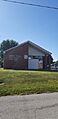
The Dubois, Indiana post office.

See also
 In Spanish: Dubois (Indiana) para niños
